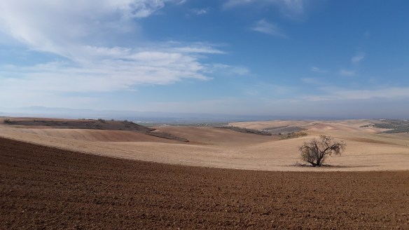
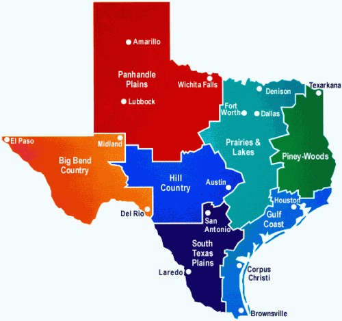
I grew up in the Texas Panhandle, a large section of Texas loosely identified as the northernmost 26 counties of the state. The region is bordered to the west by New Mexico, to the north and east by Oklahoma, and to the south, hundreds of miles from the northern border, by the Big Bend and Hill Country regions. For the most part, the topography consists of grass and shrub covered plains, occasionally interspersed with arroyos and shallow canyons. It is a vast level swath of land, some 25,000 square miles total, featuring open views in all directions. With a vantage allowing line of sight through fences, power lines, wind farms, and oil field machinery, one may note the slight curvature of the earth along the distant horizon.
From: smilingglobe.com
It is a windy place, much of the time, with a widely varying range of temperatures, each exacerbated by the blustery weather. It can be well over a hundred and blowing hair dryer hot in the summer, and snowing sideways with wind chills well into the negatives on the worst of winter days. With the winds come tumbleweeds and trash, blowing from fence to fence across rural landscapes, and yard to yard in towns and cities.
Driving the backroads, one moves steadily from one small community to the next, each in varying states of disrepair. The boom and bust cycles of agriculture, ranching, and oil are evident throughout, though when passing by boarded storefronts, broken windows, and empty brick hollows, it is difficult to imagine these main streets ever lived up to their full potential. Scattered signs of life may be observed as well: hamburger shacks with hand-lettered signs, dilapidated beauty salons with clever names, a Dairy Queen, competing convenience stores, shoe-polished slogans supporting high-school football teams—Go Eagles! On the outskirts lie weedy trailer homes and the rusted carcasses of American muscle cars—dreams left to die. The larger cities in the region prove no more stimulating—the standard repetition of box stores, fast food chains, franchised restaurants, and mega-Walmarts. Sprawl and squalor, obvious separation of wealth. The whole place exudes a certain one paycheck behind quality, a feeling of uninspired existence perhaps, though food, fuel, and other fundamentals are produced here, a concept not to be taken lightly. I confess a proclivity for criticism, having endured an adolescence stifled by an inflexible status-quo.
In short, if you ever find yourself in the Panhandle, your first thought might be of running—running away that is. At least that’s been my experience since leaving here many years ago. I have discovered, however, there is beauty to be found everywhere, and though one may have to search a little harder here, it does exist in many forms—in the open skies, those boundless horizon lines, in the wildlife, the rugged vegetation, the thrill of a multi-story dust devil, the sight of a refrigerator-sized tumbleweed bouncing along the freeway at 40 mph. There are also a few geographical gems in the region which provide opportunities for outdoor recreation, for running and camping and wildlife viewing, etc. Places worth getting to know, worth going back to time and again should you find yourself just passing through or stuck here for a while.
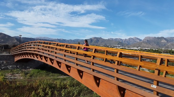
My family still lives in the Panhandle, and as such, I try to visit when possible. This usually occurs once or twice a year as I’m driving from one place to another. Amarillo, the biggest city near where I grew up, is a long ways from most of the places I’m interested in getting to—an eight hour drive even from Terlingua and the Big Bend—but as it’s transected by major interstates, planning a route which detours through there isn’t all that difficult. I’ll general stay for a week or so, a couple days in the city with my mom, and a few days hanging out with my dad, who lives in one of the neighboring towns about 45 minutes away. The past several months, however, I’ve ended up spending an inordinate amount of time here. As such, I thought I’d do a little something about a few of the best places to spend time outdoors in the region, just in case one of my fictitious, running obsessed readers finds themselves in the area. Not to mention, this may well be the last bit on running I do in a while, as it’s going to be treadmills, ice spikes, and cross country skis for long months to come once I make it up to Alaska next week.
I mainly want to give a brief description of the three best places to trail run in the entire Panhandle, from my own experience, limited as it may be and more specific to the Amarillo zone. But those three should be enough for anyone driving along I-40 or I-27 to detour to for a couple of hours of exploration, or to camp out for the evening if passing through the region. Truth be told, these three places probably cover it for the most part anyway, as outside of the Big Bend finding opportunities to recreate on land open to the public is depressingly difficult. Over 95% of Texas land is privately owned, leaving a minute amount of accessible open space for the common folk. The rest of it sits sanctioned off by boundless miles of fence posts, barbed wire, and closed gates. As such, options for running outside of city parks or municipal streets are limited to underfunded and overused state parks, or the couple parcels of federal land in Texas—one of which happens to be a few miles from where I’m typing this.
Before moving on to the descriptions, however, one running anecdote from my time in the Panhandle: As I’ve mentioned before on this site, running hasn’t played a part in my life for all that long, at least not an enjoyable one. Some years prior to the shift in attitude, however, I found myself signed up for the annual Amarillo Thanksgiving Turkey Trot. I knew that I was going to run the 5K a couple months beforehand, but couldn’t really bring myself to do any sort of training for the event, mostly because I really didn’t like running, so figured I’d save it for when I had to do it and not spend any extra effort in working up to it. I also lived in Leadville, Colorado at the time, at an elevation of 10,000’, which made running even less enticing, and also made for a convincing excuse that the drop in altitude should be enough to compensate for my lack of preparation. The inevitable Thursday morning arrived as cold and breezy as one might expect for November in the Panhandle. I showed up just as the event started, and found myself scrambling to attach bib and shoelace timing chip as the gun went off. From the back of the pack I eventually found my pace and place, ahead of the walkers, but a long ways behind the real runners, who I could see well on the other side of the lake the course circuited around. I wasn’t dying, but I certainly wasn’t having much fun. It was cold; I was out of shape and underdressed and hadn’t run three miles consecutively in many years.
About a quarter mile from the finish I caught up to a 12-year-old boy giving it his all while dressed in what would, in most parts of the country, be considered a decidedly non-PC Indian outfit, feathered headdress, war paint and all (“It’s my culture, not a costume!” read the posters around university campuses last year…). I didn’t intentionally pass him, simply labored by hoping for the experience to be over. He shot me a death glance as I overtook him. Around the corner the finish line was finally in sight, and I heard much yelling and cheering from the awaiting crowd as the kid was now high-kicking it behind me in an all-out sprint for the end. Even if I would have felt like humiliating a small child in a public setting, I wouldn’t have been able to muster the extra energy, and he bounded past to beat me by a couple seconds. I’d like to imagine that I could smoke him these days, but that’s probably not true, as he’s now about 19 and certainly quite a bit faster if he kept with the running. The most humiliating part came the next day, however, when the holiday copy of the Amarillo Globe-News arrived at my dad’s house. There it was, on the front page of the paper for all the Panhandle to see—the young brave whooping across the finish line with a panting old guy, his/my face plainly visible in the photo, struggling for breath several steps behind.
On to the rest of it then. Over the past months I’ve been able to revisit a few of my favorite spots in the Panhandle, and even discover a couple of new trails. I’ve also been running around the east side of Amarillo a fair amount (might as well grow an extra head the way people gawk from their truck windows at a pedestrian), and have come to the conclusion that winter may well be the best time to run here. The wind can be a deterrent, especially the colder it gets, but there are significantly fewer weeds, pokey things, and stickers in general, along with greatly reduced chances of seeing snakes. Slanted lighting softens the landscape. Long shadows and golden glows abound.
The three places I’d like to endorse are as follows: Caprock Canyon State Park, Palo Duro State Park, and the Lake Meredith National Recreation Area. All offer many miles of trails and excellent options for runs of any distance. There are a few other smaller state parks along the southern extension of the region, (such as Copper Breaks, which does have a few good trails), worth checking out if you’re in the area, but these are the top three if you’re looking for extended runs across inspiring terrain.
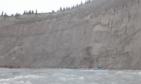
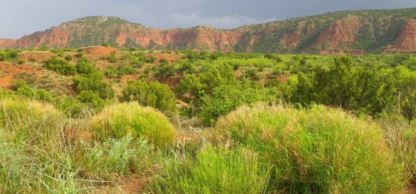
Caprock Canyon State Park
Caprock has around 90 miles of trails open to hiking and biking. It’s definitely somewhere one could spend several days exploring. For those looking to stay a while, the campsites are a highlight as they are arranged to offer privacy and great views. The trails provide lots of variety and untold options for connecting different routes. I would have stayed a few more days the last time I was there, but had to depart due to reservations made by incoming attendees of the annual Bob Wills Days in nearby Turkey, Texas. Be aware of that detail if you’re there at the end of April. Another highlight is the ‘Texas State Bison Herd,’ which roams freely throughout the park. Tatanka. Get your Kevin Costner on.
")
")
")
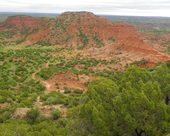
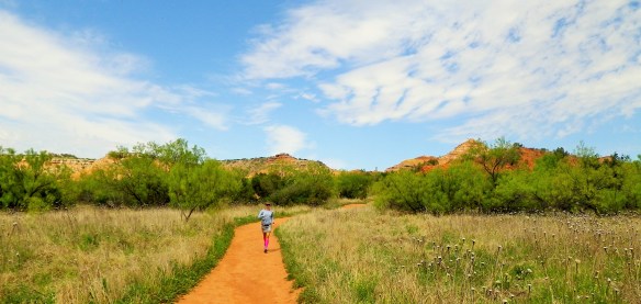
Palo Duro Canyon State Park
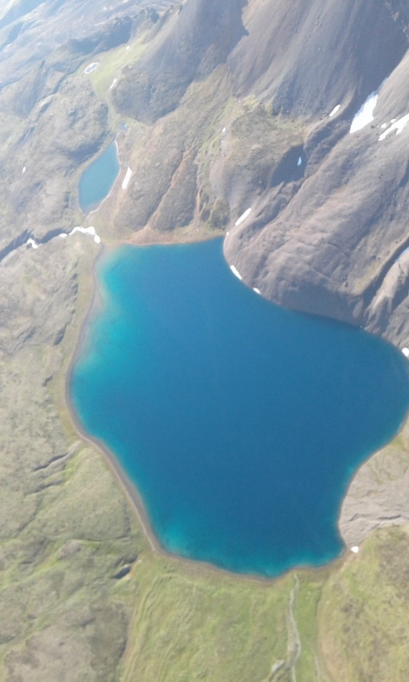
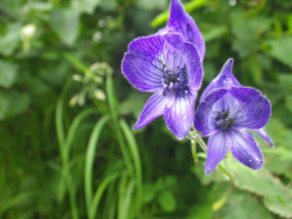
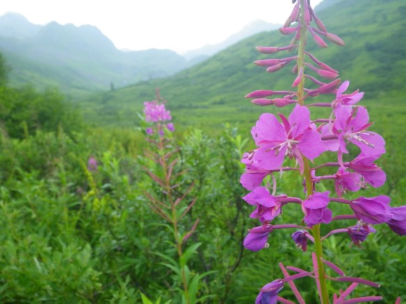
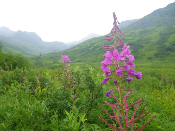
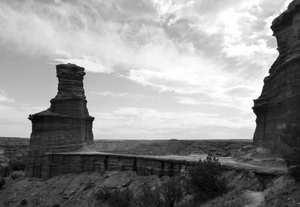
Touted in park literature as the ‘Grand Canyon of Texas,’ Palo Duro is reported to be the ‘second largest canyon in the US,’ though when I searched for substantiation of this claim I could only come up with Texas based media outlets as sources. Such is life in the Lone Star State. Regardless, it is an incredible place to visit, and an iconic landmark. Captivating landscapes, lots of wildlife and wildflowers, plenty of opportunities for camping, and great trails. You can also see the outdoor musical TEXAS if you’re there in season. I try to spend at least a day here each time I pass through, and any time of the year is a good time to visit. My favorite trail combines the Givens, Spicer, Lowry (named for three local runners) with the Lighthouse trail to make a six or so mile loop with opportunities to take spurs to the Lighthouse formation and/or Little Fox Canyon.
")
")
")
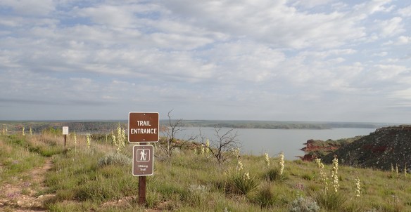
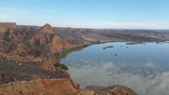
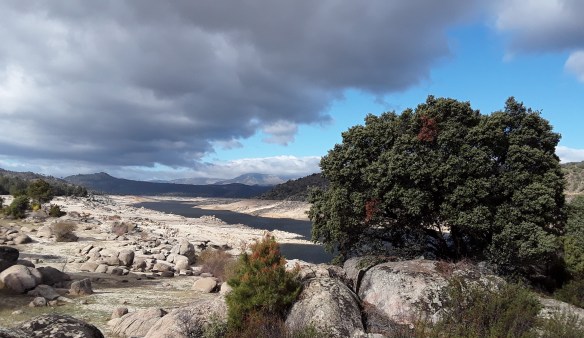
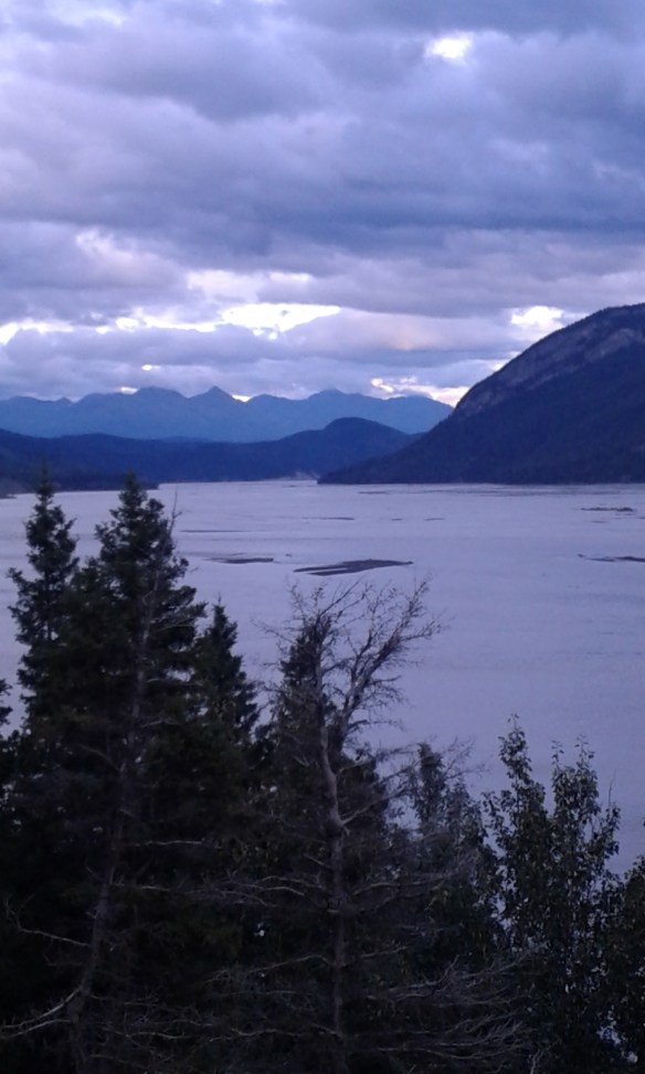
Lake Meredith National Recreation Area
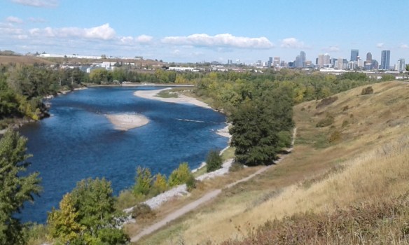
While the first two might be somewhat obvious choices if visiting the Panhandle, Lake Meredith is fairly unknown outside the local area. When I was growing up, the lake was popular for boating, fishing, beer drinking, and cliff jumping. As the years passed, however, the lake (actually a reservoir capturing the flow of the dinky Canadian River) began to recede considerably, reaching a record low in 2013. As the lake dropped, marinas and boat ramps were left high and dry, and visitor use plummeted. In an effort to increase recreation opportunities in the area, the NPS decided to begin constructing trails, and several were seen to completion. Since then, however, the lake has experienced an astonishing recovery, with current water levels actually covering sections of trail where a few years ago the lake wasn’t even visible in the distance. What this all means is there are presently miles of really sweet trails with great views of the lake along the way.
Along with NRA’s eponymous lake, the region also features Alibates Flint Quarries National Monument, a site recognized for its importance to the “survival, commerce and culture of the High Plains.” In past visits, I spent a fair amount of time here with my dad, who did a lot of volunteer work at the monument, including conducting interpretive tours of the quarries. Visiting the sites requires having a guide and a good imagination. The main sites, which sit on top of a mesa, consist of nothing more than small pits in the ground where high grade flint was extracted by prehistoric cultures to be used in trading and the construction of tools. If you’re ever in the area, it’s worth a stop by the visitor’s center, and nearby dirt roads allow access to the lake and some easy running opportunities. My dad no longer volunteers for the park service, having since moved on to other projects, but does spend a lot of time hiking around the entire area taking photographs and identifying flora and fauna. As such, anytime I’m back we spend at least a couple of days out by the lake, both on trail and off, and it’s become one of my favorite parts of spending time in the Panhandle.
There are several different areas of the recreation area with access to trails, but two of the best trailheads can be accessed at the same basic location, which is the Harbor Bay boat ramp just outside the town of Fritch. The first trailhead will be on the left as soon as you spot the lake. This is the South Turkey Creek Trail, which parallels the lakeshore for around six miles before dropping down into Turkey Creek itself, where it joins up with a four mile loop up the creek—making a 16-mile round trip route for anyone looking to do some distance. The loop can also be accessed, by an unofficial but apparent trail, from Dolomite Point, which is a short drive from the Alibates Visitor’s Center.
The second trail is the Harbor Bay Trail, which can be reached by continuing to the Harbor Bay boat ramp. From here the trail climbs for a short ways, then traverses a side canyon before crossing a creek and heading up to a mesa loop trail. From the trailhead to around the loop and back is around 6 miles. An earlier loop goes up to a mesa overlooking Harbor Bay itself. The terrain is a nice mix of up and down, the views are outstanding, and you are likely to have the place to yourself.
Welp, guess that’s about it pard. Not necessarily suggesting anyone make the Panhandle a destination, but if you happen to find yourself in these parts hankerin’ for some fresh Texas air, now you know where to go. Later y’all!
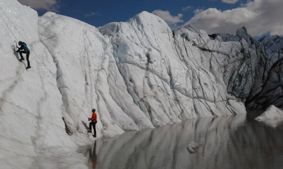
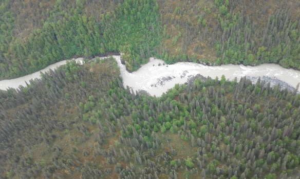
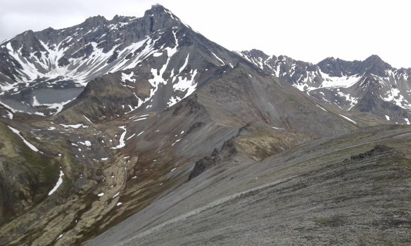
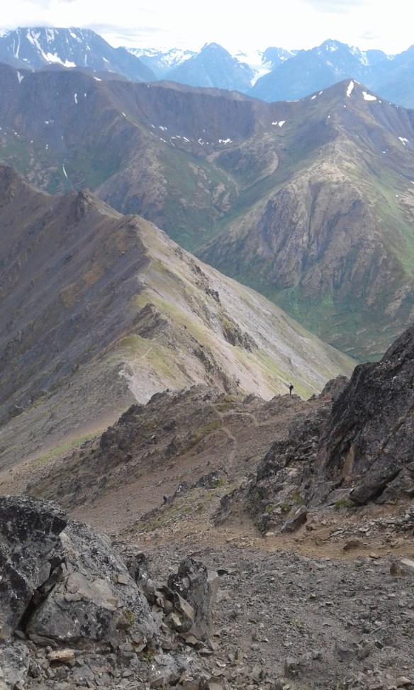
Photos below provided courtesy of Glendon Jett.