Spring 18

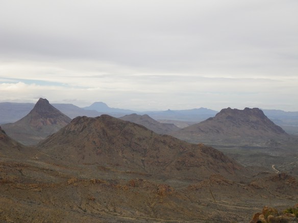
Interpretations of spring seem to vary. I forget that sometimes, only to be quickly reminded as I head north each year thinking that summer must surely be setting in everywhere else, having already spent a couple of months baking in the desert sun myself. While once an avid proponent of winter, I’ve managed to do a decent job of skipping that season for a few years now, heading south of the border for a couple of months around December and returning to the Big Bend just about the time the heat starts to set in. This winter was about the same, though we found ourselves enveloped in snowstorms in Mexico in January, and again in New Mexico and Utah in April and May. The between times, however, were spring to me, starting, as a matter of fact, in late January this year as we floated through the Great Unknown blessed by unbelievable weather, and continuing on through early April when it was time to flee the hazy skies and 100+ degree temps setting in. It was not spring elsewhere, we soon discovered, but it is always nice to see a bit of snow each year, just to know what you’re not really missing. Here are a few highlights from the past few months.

Conservation Work. Or something like that. Spent all of February working on a restoration project around the confluence of Terlingua Creek and Rough Run Creek. The project, developed by Fred Phillips Consulting out of Flagstaff, consisted of harvesting sandbar willows and other varieties of native plants, and then strategically replanting them in zones where they historically thrived before the severe denuding brought about during the ranching and mining era. By the end of the project, our team of six had planted around 4,500 cuttings. Two months afterwards, around 80% of them were sprouting, in spite of no precipitation and ruthless spring temperatures nearing and exceeding triple digits. Here’s hoping that the project continues to be a success, and that its effects last for generations to come.

IMGP6172

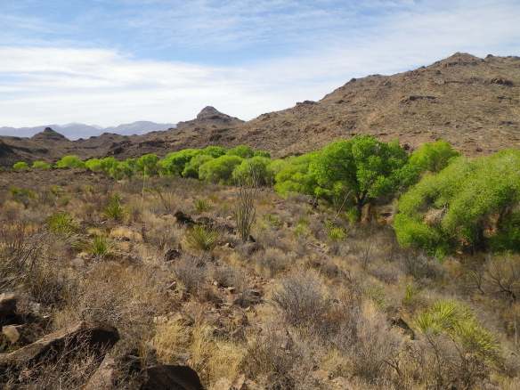
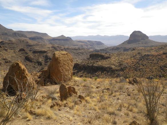
Rancherias Loop. While working on the project, we put in the standard 40-hour week, allowing time to plan weekend excursions. One trip that I’ve wanted to do for several years was a three-day backpacking trip in the state park called the Rancherias Loop. The trail leads across a wide variety of rugged desert terrain, running up a narrow canyon for the first day’s stretch, then following a 4×4 road for a few miles on the second morning, and eventually dropping down another drainage before heading up, across, and back down a huge mesa. Even in February, things warm up quick out there, and water becomes a staid concern once you commit to the trail. Fortunately, there are two fairly reliable springs along the way, spaced perfectly apart for a three-day walk, though the drier the year, the less reliable the springs become. The information at the ranger station as to their status is also of questionable reliance, as neither of the rangers that we spoke to had ever hiked the trail, leaving them to depend on sporadic reports from returning trail users. This year being about as hot and dry as it gets down there, we certainly had some anxiety with relying on the availability of water, even once we spotted the stands of vibrant green cottonwoods popping out of the otherwise dried up landscape. The first night’s stop had one bubbling brook that appeared out of the ground near the roots of one tree, and disappeared back into the ground 20’ further down. Plenty for filling up, but not necessarily for assuaging concerns about the following day’s spring. The next afternoon we arrived at even bigger stands of cottonwoods, but had to search for a long while before finding a mudhole big enough to filter out of. But, we eventually filled up every receptacle we had, and carried a couple of gallons up onto the mesa to a dry camp and a stunning sunset. A great trip and a great trail with lots of varied terrain along the way.

IMGP6186

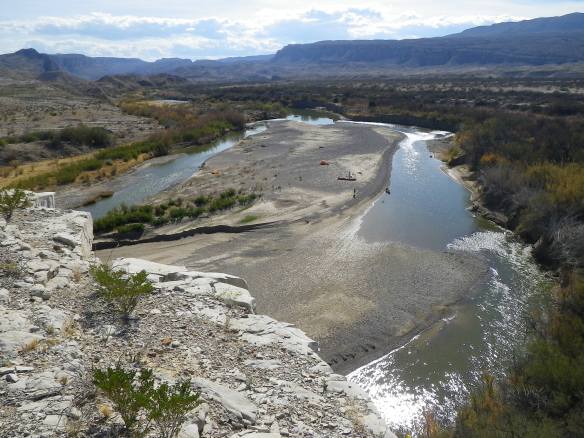
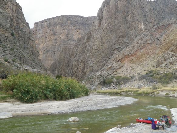
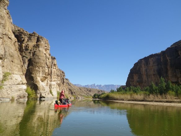
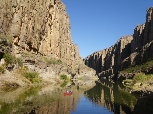
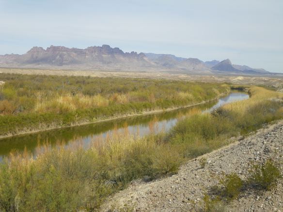
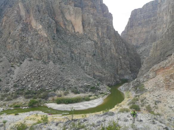
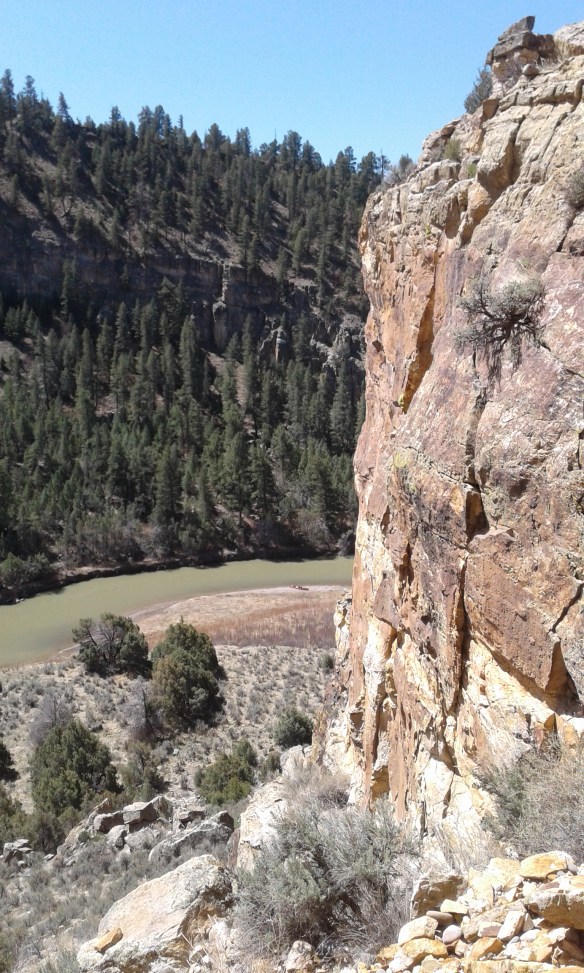
River Guiding. From the end of the project in early March, until the beginning of April, we guided canoe trips on the Rio Grande, which has been a spring staple for several years now. This year, the busiest few weeks of the season were enough to satiate my annual desire to run commercial trips down there. I will always love the Big Bend, but the river continues to drop to near dismal levels each spring while the temperatures continue to rise, the wind rips up the canyons, the long drives to and from the river only get longer each day, and the crowds are getting there earlier and sticking around later… Still, however, I love it somehow, working down there, being in the canyons, being on the river, even if I’m dragging a canoe up a canyon instead of floating for days down through it. Love it for a little while, at least. And I did get to do a Boquillas Canyon trip, four days of downstream travel on my favorite stretch of the Rio Grande, which also meant that I got to float the full length of the park plus some this year. Pretty awesome. At the end of the month, my mom came down south to visit for a week, which was a whirlwind of a Big Bend tour and hitting all of the highlights from Balmorhea to Ft. Davis to Ojinaga to both Big Bend parks and several other state parks and a few miles on the river in a canoe to boot. Was great to get to show her around and let her in on a bit of van life for a while.

IMGP6237

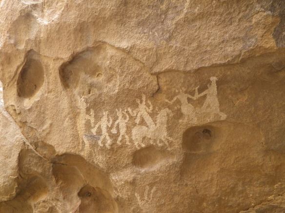
New Mexico. After dropping my mom off in Midland, we headed over to New Mexico for a few weeks, primarily to attend a couple of classes, but also just to do some poking around. On the way over we stopped off in Guadalupe NP for a run up McKittrick Canyon followed by dinner at the Frijole Ranch, and then spent the next morning touring around the pictographs at Hueco Tanks SP. That afternoon, we drove into downtown El Paso and took a quick walk over into Ciudad Juarez for some lunch. In spite of all the stigma, Juarez seemed like every other town in Mexico I’ve ever been to, just a bunch of decent people trying to go on about their lives. And good tacos. After that, it was leaving Texas and a couple days of driving up to Taos, where we spent three days renewing our Wilderness First Responder certifications, followed by a week of swiftwater rescue instruction with Tommy Gram from the American Canoe Association. Both classes were excellent, and after receiving our instructor credentials with the ACA, we headed west for a ways to check out the Rio Chama.

20180418_101758

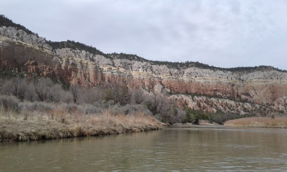
Rio Chama. I’ve wanted to run the Chama for years now, but was never in the vicinity at the right time. Now we were, and with one of our beater canoes along to provide the ride. Having heard only that the Chama was awesome, with no real specifics, I suppose I had no idea what to expect, nor had I put any significant thought or effort into finding out what the run might entail, other than ensuring that there wasn’t any major whitewater to be encountered along the way. I guess, due to its relative closeness to the San Juan in Utah on a 2-D map devoid of elevation markers, I’d always imagined it would be desert river, and somewhat warm in mid-April. Not so. From the mountain town of Taos, we drove up to get there. Up and up and up. And then down a little, but not that much. Our first day on the water the wind blew cold and steady at around 30 mph. That night the temperature dropped down into the low 20s. It warmed up a little the next day, but not much. We were adequately prepared, but it was still pretty dang chilly for most of the four-day trip. Early early spring in the Rocky Mountains. Snow on the tent the last morning.

20180419_141410

It was quiet out there, being still winter like, with almost no signs of life other than birds. At one point, after trying to name all the avian species of the morning, I said aloud that I’d like to see at least one mammal. A bear, perhaps. And about two minutes later we floated past a strange looking piece of fur on the right bank. It took while to realize that it was in fact the fluffiest blondest little bear cub I’d ever seen, just kind of hanging out all alone waiting for its mom to return. And that was about the only land based creature we spotted other than a couple of squirrels and a bunch of cows and a few other humans.

20180418_113855

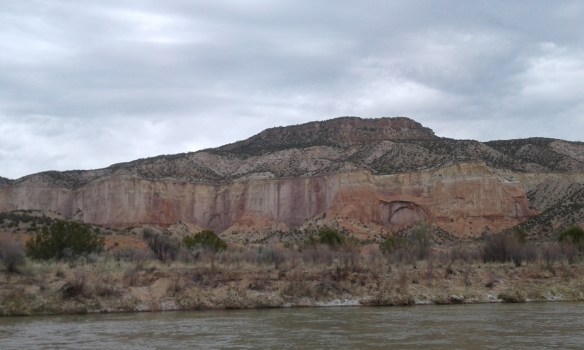
The scenery was spectacular. We floated through open canyons of mixed conifer forest interspersed by massive multi-hued sandstone walls extruding along both banks. Walls of purple and orange. Other highlights were fossilized dinosaur tracks up one wash, a hot spring, and several short side hikes with stellar views of the canyon. With the flows we had, it was fun canoeing with steady current, lots of riffles, and the occasional rapid. Near the end, the rapids got a bit bigger, and we swamped pretty good dropping into a big ledge-hole at the bottom of Bridge Rapids, barely making it to shore and calling it our last night’s camp as we pulled everything out of the almost capsized canoe. That evening, we went for a run on the Continental Divide Trail, which happened to cross the river on the bridge just upstream of us. The wind went back to blowing cold, and continued to do so till the end. We navigated a couple more rapids the next morning, packed up, and ended up finding a few unanticipated diversions in the hours to come.

20180419_120725

Abiquiu, New Mexico. After packing up our gear, we debated as to what to do next. Having been slightly cold for several days, and with the breeze going, and big thunderstorms blowing in, the hike up to the canyon rim we’d been discussing lost its appeal. We decided to check out a couple of nearby locations on the map, with no real destination in mind. Just the way I like it. And it ended up being a really sweet day. The first stop was Echo Amphitheater, just up the road. The site is a monstrous sandstone amphitheater, as the name suggests, a huge half-dome of naturally sculpted rock. We hung out for a while with the place to ourselves, ate lunch, made some noise, checked out the acoustics. From there we drove a few more miles and visited the Ghost Ranch, where we were surprised to see hordes of busy artists scattered across sprawling parking areas diligently producing landscapes in a variety of mediums. And the natural landscapes they were attempting to recreate, albeit while leaving out the car-crammed chaos of the parking lots they chose to stand in, were indeed unique and amazing, replete with towering spires and animated colors in constant flux due to the briskly shifting clouds. Knowing nothing about the place when we entered, we eventually learned that the ranch was a long-time base of the famed artist Georgia O’Keeffe; many of her works can be directly correlated with iconic rock formations found around the ranch. The site also has a lot of history with Hollywood movie production, as an impressive list of films have shot parts here, and as a paleontological site of renowned interest. A bit overwhelmed by the crowds of people and their easels everywhere, we decided to take off after a short visit to the museum and headquarters. Less than a half-mile back out the driveway, we found an easy ridgeline trail to stroll along with incredible views of the surrounding features and not an artist in sight.

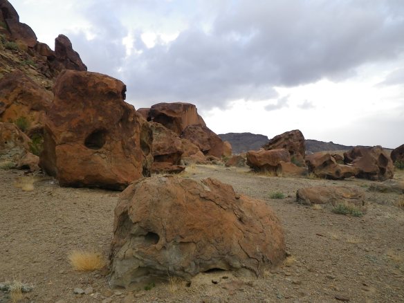
From there, we drove a few miles to the town of Abiquiu, a name I’d recognized from a post on a random blog I’d read two years before. The basis of the article had to do with a church of sorts, the still utilized meeting place of an archaic religious sect, a secret brotherhood of practicing penitents. I won’t get into the details here, but will say that we somehow happened to stumble upon the site on the outskirts of this odd little town, which had a distinct aura of insularity about it. The town itself, that is, whose empty dirt streets were enough to kindle a strong sense of foreboding. Aside from the church (technically a ‘morada’), there wasn’t much to the town other than another church, a library, and an art gallery, which we visited on our way out of town. The gallery itself housed an eclectic collection of pieces from around the world, with one half of the location packed with myriad Buddha sculptures and African peculiarities, and the other half filled with a combination of Americana kitsch and Indian weavings. None of it seemed to be priced to sell, but I don’t think I qualified as the target clientele. The most interesting part of the gallery turned out to be the manager, who offered us a detailed history of the Abiquiu area. As we were leaving, I asked him what his personal interests entailed, and he mentioned photography, pointing to a few works mounted on the wall which I’d been admiring earlier. I asked him where one of them had been taken, a shot of a distinctive rock formation I’d never seen before, and he told me that it was from nearby, at a place called Plaza Blanca, another site frequented by O’Keeffe. He gave us directions to get there, I thanked him sincerely, and we headed out of town. We ate dinner beside the Chama, and then drove several miles down another dirt road to arrive at Plaza Blanca, which actually sits on private land owned by an Islamic foundation which sponsors educational programs at their mosque a few miles outside of Abiquiu. Another story in itself, as you can imagine. Anyways, we spent a couple of hours wandering alone around the ‘Plaza’ which is actually comprised of many acres of spectacular surrealistic landscapes. Formations of white rock sculpted by wind and water. The sun began to set about an hour after we arrived, softly shifting both sky and sandstone through revolving pinks and blues. A perfect end to an inspiring day.

Utah. Well, really Texas, Oklahoma, Arkansas, Tennessee, Nevada, then Utah, but mostly just Utah. The day after taking off the Chama, which was also the day with the amphitheater, the Ghost Ranch, Abiquiu, and Plaza Blanca, we decided to head out of New Mexico and on towards Tennessee, where we were planning on leaving the van for a while as we traveled on to Utah, then Peru, then Alaska (where I’m finally getting around to writing all of this…) So it was out of New Mexico, USA (distinguished on their license plates for some reason), over to the panhandle of Texas for a quick visit with the folks, across Oklahoma on the freeway, and then onto some Arkansas backroads through vast miles of flooded rice fields for a change of scenery. It was a couple of days in Tennessee hiking and running around a couple of state parks, followed by a long day of airports, delays, lost luggage, and an eventual arrival in Brian’s Head, Utah about 24 hours after waking up in Tennessee.

IMGP6268IMGP6382

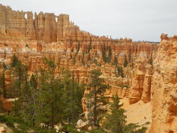
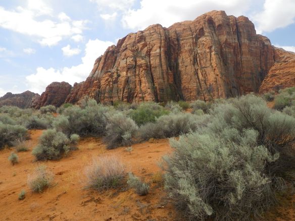
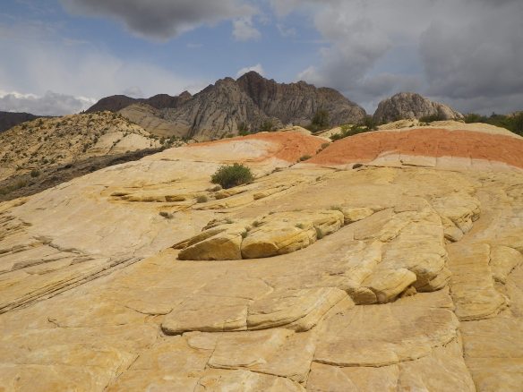
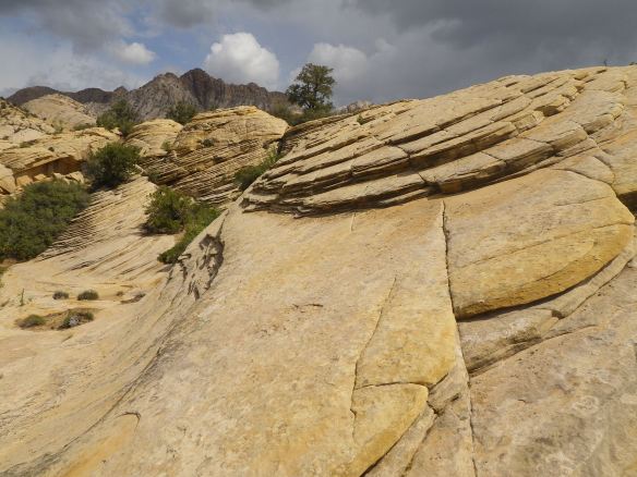
The week in Utah was hanging out with Erin’s family. Lots and lots of driving, some day hiking, and several different parks – Bryce Canyon, Zion, and Snow Canyon State Park. It was navigating throngs of other visitors in the insanely crowded national parks, and having a bit of space to ourselves the days we didn’t go to the national parks. It was cool weather, sunshine at times, and a day of heavy snow. It was hotel living and internet service and all the hot water you could handle. I think those things are commonplace for most people, but not always part of my personal reality. It was healthy eating and plenty of sleep. It was another good reminder that March and April really only mean spring when you’re in the Big Bend. In the most parts of the country, it’s still winter, apparently. I forget that some years. So yeah, Spring 18, and now for my own annual winter – summer in AK.

IMGP6372IMGP6366

Run Big Bend!

IMGP1814

With so much space dedicated to the Big Bend on this site, perhaps it’s best to clarify approximately what we’re speaking of. The Big Bend is a fairly remote region of West Texas. Its moniker stems from the topographical representation of the Rio Grande River on a map, specifically the slowly curving 300 something miles of it that gives Texas the lower left bit of its iconic shape. As mentioned in other posts, the bend also happens to be the international border between the US and Mexico. It’s Texas on one side, and the states of Chihuahua and Coahuila on the other. The entire region, more or less, lies within the even more expansive Chihuahuan Desert. While some use the term to refer to the national park of the same name (which encompasses over 800,000 acres at the point of the bend), or the park and the nearby towns of Terlingua and Study Butte, the broader Big Bend, in both character and atmosphere, extends a bit further north as well. While the boundaries aren’t displayed on any map that I know of, most folks would probably agree that a line connecting Presido, Marfa, Alpine/Ft. Davis, and Marathon would represent a general idea of the upper stretches of the Big Bend proper.

Having mentioned all this, however, the heart of the Big Bend, in my opinion, does indeed lie along the border stretches, and it’s along those border stretches where one can run for seemingly infinite miles through rugged, remote, and extraordinarily beautiful desert terrain, most of the time in complete seclusion.

The difficult decision as far as running in the Big Bend never seems to be where to go, as everywhere delivers as far as stark splendor is concerned, but when to go, especially as far as time of day is concerned. Over the past four years I’ve spent a good deal of each winter and early spring in the area, which, unless you’re some freakish cold blooded mutant that thrives in triple digit thermometer readings, is the time of year to be there. Even in December, afternoon temps can be quite warm, and by early March daily highs often creep towards 100+ on the desert floor. There can be cold days and windy days in there as well, which can make for some frigid runs in the winter, but the best part about the Big Bend in January and February is that storms seem to roll through for a day or two at a time, rather than sticking around for long weeks. And cold quickly becomes relative, with wind chill being the biggest factor in run enjoyment.

So, the biggest decision is usually when to start your run once things start warming up again, especially if you’re planning on doing any significant distance. Early in the a.m. is always an option, though it can be brutal to head out just before the sun breaks the horizon only to have things heat up by 20 degrees or more 15 minutes into it. You’re wishing you had gloves and some nipple tape one minute, and tearing off your sweat soaked layers and dying for water the next. My favorite time to go is as close to dusk as possible, but this can also become problematic, as the Big Bend sits on the far western edge of the central time zone, meaning that sometime around the first of March the optimal departure time might be around 7-8 pm, a little late in the day if you have any other plans. Having offered these two options – uncontrollably shivering-to-profusely sweating or sunset mission – the most important thing to mention is that in warmer seasons the meanest time to go is anytime between 3pm and early evening. Around 4 o’clock each afternoon the sun reaches a particularly vicious angle, its rays intensifying significantly. If, as I have so many times before, you allow yourself to be lured into running in the afternoon, the magnified heat and ferociousness of our sky dwelling friend and tormentor will make you feel as if God has singled you out for punishment. Something you may want to experience for yourself, but don’t say I didn’t warn you.

As for the where…

Big Bend Ranch State Park. One of my favorite places to run anywhere. Texas’s biggest state park, by a huge margin, only receives a small fraction of visitors compared to the neighboring national park. At over 300,000 acres, with a well-developed and maintained trail system easily accessible from the highway, Big Bend Ranch offers an austere paradise for those seeking solitude in the desert. I regularly run long loops in the park, and other than the two event weekends of the year, have yet to see another person on the trails. I’ve even run a trail two weeks after I originally ran it, only to recognize my own footprints in the dirt. The running is phenomenal, as are the surrounding mountains and desert vegetation. Some of the trails are old 4×4 roads, while most are single track with technical sections and undulating elevation, and there are untold options for connecting routes. The two best spots to access the main trail system are across from the Barton Warnock Center, which is one of the park’s headquarters just outside of Lajitas, and the Contrabando trailhead. Perhaps my favorite run starts at Contrabando, heads out towards the Dome trails, and returns via the Fresno Divide. And if the thought of running solo in the wilderness is in any way uncomfortable, I’ll mention that each January there is an ‘Ultra’ with distances of 10k, 30k, and 50k. Kind of fun to run with a small crowd out there one day a year. It’s also worth noting that the trails are open to mountain biking, with a bike festival happening each February.

IMGP1809

Lajitas Airport Trails. East of the resort town of Lajitas sits the Lajitas International Airport. I’ve never seen a plane land or take off from there, but I’m told that they do. The important thing to know, however, is not that a flight to the Big Bend might be available if you know the right people, but that there is a network of trails open to public use accessible from the highway at the airport turnoff. These trails are only slightly more popular than the state park trails, as local mountain bikers ride them with some frequency, though the chances of having them all to yourself is still likely. At the trailhead is a map with routes, descriptions, and mileage. The trails are well signed and provide a diversity of terrain and scenery. As the trails are a bit closer to the town of Terlingua than the state park, one of my preferred sunset runs is the 5.5 mile Loop 3, with great views of the Chisos Mountains on your way out, and often brilliantly colored clouds across the western sky on the way back in.

Horse Trails? Town Trails? Study Butte Trails? These don’t have a name that I know of. In fact, I’ve never thought of calling them anything until now, though I run on them more than anywhere else since they’re a) awesome, and b) begin in the town of Study Butte (aka Terlingua, but not the Ghost Town) just behind the Motor Inn, which is now called something like Big Bend Resort and Adventures… Anyway, just behind the gas station/laundromat/campground there’s a dirt road that leads past a water treatment pond and through a pseudo golf course which is basically just a few greens and a couple of flags out in the desert. As you’re passing the shitpond, just find a trail and start running east, or south, or even north, anywhere but back to the highway. There are trails heading all over the place which are primarily used by the nearby stables to do trail rides. You’ll see a lot of ‘evidence’ of the horses, but their hooves do keep the trails nice and soft. You may even see some folks out on a ride, but there’s usually an alternate trail to turn off onto before you meet them, and the wranglers are friendly enough if you end up in the mix. It’s fun just to figure some things out for yourself, but as you choose your own adventure the trails might take you past old mining ruins, up Rough Run Creek, along a sweet ridge, on to Ocotillo Mesa, and even all the way back to Indian Head, which is the northwest corner of the national park.

IMGP1820

Big Bend National Park. To be honest, I haven’t done much running in the NP. Lots of hiking, lots of canoeing, but hardly any running and nothing noteworthy at that. There are plenty of options, however, just a lot more people and potentially long drives to get to the trailheads if you’re not staying in the park. Most of the trails are clearly marked and travel through some striking terrain. You also have the option to run up in the Chisos Mountains, where the temps are generally significantly cooler than in the desert down below. They are real mountains, however, so be prepared to run up/down a mountain, and the trails, as already alluded to, will be more crowded in the Chisos than anywhere else. If you want to do some desert running in the park, try cruising along one of the unpaved roads, such as the River Road or Old Ore Road. (Avoid Maverick, unless you don’t mind being plastered in a dirt patina from the clouds of dust you’ll be eating each time a car speeds by on the washboard.) Or, for a more authentic trail experience, head out the Marufo Vega until the junction with the Strawhouse Trail and follow the wash back down. Epic desert views abound.

IMGP1796

Terlingua Ranch. The Terlingua Ranch comprises thousands of acres of land adjacent to the national park and north of the Terlingua Ghost Town. While a true working ranch in the late 1800s, the land has now been parceled off into small swaths of barren desert. As you approach Terlingua from the north, you will begin to notice all manner of dwellings scattered across the landscape for as far as the eye can see, an unbridled sprawl of anything from conscientiously built eco-homes to abandoned buses and decrepit trailers. Personal junkyards abound. All of this is connected by an immense network of private dirt roads maintained by the Ranch. I mention this here because with the ever-growing popularity of Airbnb in the area, many visitors find themselves ensconced on the Ranch somewhere along all those miles and miles of dirt roads in lodgings which are many more miles from anywhere near the parks. All of the above mentioned locations are much more enjoyable to explore, in my opinion, than the Ranch, but, having said that, I run out there quite a bit and the empty roads provide plenty of possibility. I will say that running out there can be a bit intimidating. It’s like jogging suspiciously across the set of a bad Billy Bob Thornton movie – you will find yourself looking cautiously between rusted cars and bullet riddled washing machines, knowing that a heavily armed someone might certainly be living in one of the decaying vans in the back, and imagining that they’re not the kind of people that live out there because they want to see some dude in short shorts trotting through the privacy of their conspiracy riddled reality. Keeps things exciting, I guess, the wandering imagination that is. I will end by saying that the Ranch can be a great place to see wildlife, such as deer and javelina, and you can take your dog along, which you can’t do in any of the parks. So, if it’s where you’re at, get after it – the gunshots will be a strong motivator for negative splits on an out-and-back.

IMGP1860

Davis Mountains. As mentioned in the beginning, the Davis Mountains lie at the far north of the Big Bend, and are often included in vacations to the region. This area is home to the McDonald Observatory, Ft. Davis, Davis Moutains State Park, the Chihuahuan Desert Research Institute, and by far some of the most scenic driving in the state of Texas. And, if you happen to be there, they’re also home to some great running trails through those very mountains and the northern part of the Chihuahuan Desert. The Research Institute has several miles of desert trails (along with botanical garden and a cactus greenhouse), while the state park offers multiple options traversing some steep rocky terrain. To test your mettle try starting at the campground, heading straight up the Old CCC Trail, dropping down the Fort Davis Access Trail, running around the fort, returning up the canyon and then up some more and all the way back down the Skyline Drive Trail. The other side of the highway also offers a challenge in an 11-mile ‘lollipop’ including the Sheep Pen Canyon Loop. Keep an eye out for the aoudad.

I guess that’s it. A brief guide to running in the Big Bend. Watch out for snakes, the sun, and all the spiky things. With hundreds of miles to choose from, I probably won’t see you out there, but have fun exploring.

The Great Unknown

IMGP6082

About a week after our last trip to Mexico, we’re back again. This time it’s a quick trip across the border into Ojinaga, Chihuahua and an easy walk over the bridge and into town for a big food buy in preparation for some days of canoeing on the Rio Grande. From our last border crossing back into Laredo, Texas it was a night of sleep near Lake Amistad, then the drive west over to Terlingua, where we generally spend several months each winter guiding trips on the river, and doing lots of hiking, backpacking, canoeing, and running when work gets slow. While here, we usually make the journey to ‘OJ’ every few weeks or so in order to stock up on fresh produce and other items not generally available in the ‘nearby’ towns of Presidio and Alpine (both 80 miles away). Most times we try to combine a trail run and night of camping in the Big Bend Ranch State Park and make a day or two of it rather than drive there and back in the same day.

An afternoon in ‘OJ’ usually starts with a big lunch at Lobbys, a popular local restaurant, followed by a serious bout of shopping at the Al Super, the biggest supermarket in town. Depending on whether or not we drive or walk, which mostly depends on if I’m feeling like it’s worth it to get hassled/searched for driving a van filled with random boxes packed with camping supplies and river gear, we might also make a few stops at the fruit market, the tortilla factory, and maybe even sit around in the shade of an ice cream shop for a frozen fruit bar before coming back over. On this particular day, we walk across with empty backpacks, enjoy our lunch, and then go straight for the groceries, loading up with a couple of weeks’ worth of food for the river trip, which we’ll start the next day, though this already feels like part of the adventure, hence the inclusion here. The walk back to and through customs takes a half-hour or so, and then it’s back in the van and heading out of Presidio. That evening we stay in the state park, as per usual, get up and run some trails the next morning, and then head over to Lajitas and the put-in, where I drop off Erin and the gear before heading off for the necessary tedium of the long shuttle that awaits.

Each year I come down to the Big Bend, I usually have several trips/missions in mind that I want to do before leaving again in the spring. Sometimes those trips entail checking out something totally new, while others are repeats of trips worth revisiting. This trip happens to be one of the latter, in a way, though with a couple of changes to the start/end locations and canyons floated from some years earlier. It’s a trip on the Rio Grande along the border of Big Bend National Park, which also happens to be the international border, right bank Mexico, left bank Texas if one is oriented downstream. The majority of boaters who come down to float the river are generally most interested in paddling through one or more of the several deep canyons found along the 118 miles of river forming the park boundary, which are awesome and certainly worthy of attention. Most trips through the canyons generally start and end near the entrance and exit of the canyons, which clearly makes sense if that’s what you’re down here to see and only have a few days to a week or so to see them in. As such, there is a lesser frequented section of the river, a section that winds slowly along the through the open desert, which receives far fewer visitors each year than the canyons. Due to this relative unpopularity, most folks refer to the section as the Great Unknown. And it is the Great Unknown, with the addition of a couple of those awesome canyons, which we are planning on paddling.

IMGP6037

We’ve allotted nine days to travel about 95 miles total on the river. Sounds easy enough in writing, a measly 10 miles a day, but making miles on the Rio Grande can be a tiresome process depending on how low the water might be, and how fiercely the upstream wind blows. Even on the best of days, paddling more than a couple of miles in an hour can be a chore, and on the worst of days, going even one mile downstream in a canoe can be literally impossible. And down here, it’s best not to ever plan for the best of days.

The crew consists of myself, Erin, and my pops, Glendon, who’s driving down from the Texas panhandle to join us. I love my dad. He’s one of the smartest and most content human beings I’ve ever met. He’s constantly reading something interesting, and always cultivating curious new hobbies such as making and utilizing atlatls and bows, fashioning native flutes and other instruments, studying native grasses, etc. The list fluctuates continually, and I have endless respect for his dedication to lifelong learning. He’s also a lot more of an outdoorsman than he admits, as capable and enduring of a hiker/backpacker/camper as you could ask for, and he never complains about anything – though you wouldn’t know either one were true if you ever read his pre-trip correspondence, which always expresses great concern as to potential weather and his unfounded fear of somehow physically encumbering whatever plans we’re trying to coordinate. To date, I’ve never outwalked him, though we might not always travel at the same pace, and I certainly tend to grumble about the wind, rain, and cold way more than he ever has, especially since that’s never that I’ve heard. We’ve done a lot of great trips in the outdoors together over the course of my life, and over the past couple of decades he’s met me in a lot of different locations, from Colorado, to Alaska, to Costa Rica for a range of different adventures. He’s also been down to the Big Bend several times, including my first time down here when I was a kid, but this will be our first real river trip in this part of the country.

In order to run our own shuttle, my dad and I arrange to meet at the take-out, Rio Grande Village in the national park. He drives down from the panhandle the day before, staying the night in Ft. Stockton, and we both arrive at RGV around 11 a.m., leaving one vehicle and getting right back in the other one for the lengthy drive back to Lajitas. We make it to the put-in around 2 p.m., where Erin has done almost all of the boat rigging and even has lunch waiting for us. It’s a beautiful day. Blue skies, no breeze, maybe 75 degrees out. A true gem of a day, in fact, and over the next nine days we are to be blessed with day after day of amazing weather. Probably the nicest continuous stretch of atmospheric pleasantness I’ve ever experienced down here. There is one chilly morning, one slightly breezy afternoon, one evening of rain, but other than that, nothing but sunshine and no wind – which, if you’ve ever spent much time on desert rivers, is almost unheard of. I’ll credit Papa for the good karma.

IMGP6139

River flows are typically low this time of year, and this trip is no exception, though there is sufficient volume to cover most of the rocks and even a bit of current now and again. That afternoon we paddle about five miles downstream. Erin paddles her own boat, while Glendon and I go tandem in the second canoe. Both of the boats are second-hand beaters Erin and I purchased from the river company we work for, and not designed for anything even close to expedition boating or even smaller rapids, but they float and carry gear and are basically good enough for just about any stretch on the Rio Grande. Having said that, however, Glendon and I come as close to flipping as we will the entire trip about an hour or so into the first day while navigating our way down a skinny channel in a shallow rock garden. The boat low sides through a slot, we lean hard to the right, but still fill up with a significant amount of water and barely make it to shore before tipping over. Funny, but not necessarily the way to inspire confidence at the beginning of a long journey. The next morning our wonky load has us tilting sideways for miles before we finally pull over and reconfigure all the gear in the boat, which sets us up right for the rest of the trip.

That night we make camp on river right, in Mexico, that is, getting everything set up in time to cook dinner and wash dishes just before dusk. One of the more controversial aspects of paddling on the Rio Grande is the fact that it serves as the international border, though, for now, in our potentially pre-wall era, there isn’t anything glaringly different about any one side. This is surprisingly surprising to many of the tourists who visit, and I’ve never been able to figure out what they imagined they would witness when gazing across into Mexico. I suppose the severity of their conceptions could be directly correlated with the amount of corporate media consumed on a regular basis. The same animals live on both sides of the river, the same birds fly back and forth. The same vegetation lines both banks, canyon walls rise on either side or the desert extends in all directions. Sometimes there are great campsites on the left, other times on the right, and there can be long miles between those campsites. It’s a river. And it’s pretty much impossible to only paddle on the left side of a river, which means you’re constantly crossing the border, officially the deepest channel of the river, all day long.

On paper, on your permit, you are forbidden to step into Mexico other than to scout a rapid or portage. In practice, it’s never really worked quite like that. Even on commercial trips, we’re often eating lunch in Mexico, or hiking a side canyon, or even spending the night on the right bank. Guidebooks highlight features on both sides of the river without discrepancy. For decades, river runners have traveled the river as any other, exploring sites of interest on either bank, lunching wherever there’s shade, camping on grassy flats or sandy beaches regardless of nationalistic labels, following the same wilderness ethic without distinction between governing entities or geographical specifics. Recently, however, due to so much vitriolic attention directed towards our southern neighbors, it seems inevitable that consideration must be given to the prudence of this practice, and those thoughts are on my mind that first night, and throughout the trip, a lot more than I want them to be. I’ll leave it at that. We still camp in Mexico that night, and a couple of other nights throughout the trip, just like I always have, just like common sense would dictate one would do while floating down 100 miles of river, but without quite the same serenity as before, perhaps the one downer of the entire experience.

That night we build a small driftwood fire in the firepan and hang out talking for an hour or two before bed. This ends up as the standard for the trip, and is another reason I appreciate having my pops along. Spending so many days and nights of every year in the wilderness, I practically never bother to build a fire. It simply doesn’t occur to me to do so. I suppose I got out of the habit years ago, and no longer associate camping and campfires, as most folks who only spend a few nights outside each year might do. Once it gets dark, I quite enjoy sitting around and looking up at the night sky for a while, and then usually read in bed until it’s time to sleep. This can make for some long nights in the winter months, not to mention chilly evenings, so it’s great to have someone along that’s motivated to gather wood and get a blaze going each evening. We talk about nothing in particular, or nothing at all, simply stare at the fire and enjoy the quiet of the desert.

Relative quiet that is, for another factor to doing trips down here involves the ubiquitous livestock found along every mile of the river. While parts of the Mexican side enjoy a somewhat vague level of federal protection, most of the adjoining land is used for grazing, and, believe it or not, herd animals seem disinterested in recognizing the river as an international border. As such, horses, mules, and cows will be encountered frequently on either side, and are often nonplussed to find humans occupying their nighttime grazing areas and water holes. The beach we are on is no exception, and sometime in the middle of the night a troupe of galloping horses storms through the middle of camp, bringing quick awakenings and unwanted imaginings of bandidos riding upon us. A quick head thrust outside the tent reveals that it’s only frustrated mules looking to graze in their usual spot, however, and they reluctantly choose to move on to perhaps less green pastures rather than roam among the strange tents on their home turf. Several nights later we have a more intense encounter with a proudly prancing gelding intent on intimidation, and have to get out the pots and pans in order to scare it away for good.

In the morning, we wake up, laugh a bit about the horses, and pack up the boats. We float and paddle for several miles through open canyon country, spotting a roving fox on its morning patrol and various ducks, flycatchers, and other birds. We stop at a spot called ‘metates’ and spend a few minutes pondering holes worn deep into bedrock from the grinding of mesquite pods used in the production of flour by early inhabitants of the area. Up on the cliffs around us we spot a herd of about 30 aoudad, or Barbary sheep, a non-native species of mountain sheep that were introduced as game animals on Texas ranches back in the 50s. Aoudad (pronounced aw-dad), native to northern Africa, have since escaped the private ranches they were originally released on, and now thrive in the harsh desert environments of several southwestern states. All over the Big Bend they continue to proliferate, to the point that they are open-season animals for hunters here (though not in the park), and are slated to be targeted for significant numbers reduction by the National Park Service, which considers them a threat to the ecology of the area for multiple reasons. All the same, it’s pretty awesome to see them in what certainly seems like their natural habitat, to admire their climbing agility and determined adaptability. We watch their red bodies move gracefully upwards, almost entirely camouflaged against the desert rocks, until they simply disappear into the mountain.

We lunch at the entrance to Santa Elena Canyon, and hike up to an overlook for a quick peek into the shady depths we’re about to float through. The canyon is a narrow slot through two massive limestone mesas. Around seven miles long, its walls reaching heights of around 1500’, it’s one of the main attractions in the national park, and an inspiring sight from all vantages, through especially impressive from the river. As we enter the canyon in our canoes, the temperature drops significantly and the current picks up a bit, giving the experience a slightly ominous feel. We navigate a few easy riffles, and line the boats through a couple of others where the current surges into banks lined with overhanging river cane. About a mile into the canyon, we come upon Rock Slide, where an eponymous event centuries prior left monstrous house-sized boulders strewn across the river in a difficult maze. With a bit of lining, dragging, and paddling, we manage to get our boats through the confusion, and then spend the rest of the afternoon drifting slowly downstream, our necks craning upwards as we attempt to take everything in. Reluctant to float through the entire canyon in one day, we decide to camp a couple miles above the exit. Knowing we won’t have any sun the next morning to animate us seems a small price to pay for a sublime evening spent on a rock beach in the bottom of such a wondrous environment. That night, the near full moon illuminates the canyon walls, surrounding us in silvery blue light.

IMGP6112

The next day we leave the canyon mid-morning with cold fingers and toes, happily paddling as we continue past the usual take-out, and officially enter the Great Unknown. Around the first corner we’re immediately rewarded with big views of the Chisos Mountains and Cerro Castellan. A few miles downstream, we stop for lunch at Cottonwood Campground, a popular birding destination in the park, temporarily closed for repairs, but easily accessible from the river allowing us to have the place to ourselves for long enough to sight several colorful species including vermillion flycatchers and golden-fronted woodpeckers. Back on the river we float past a great-horned owl as it snoozes in the sun. That night we camp on a low beach with a good view of the Chisos in the distance. A fiery sunset turns clouds and mountains brilliant pinks and reds.

IMGP5988

The next six days we paddle, hike, camp, repeat. We swim a bit, bask in the morning sun, seek shade in the middle of the afternoon, sit around a fire each night. On the river it’s mostly steep, cane lined banks, though there are occasional glimpses of ever-changing desert scenery as we slowly make our way downstream. There is wildlife in abundance. A short list of birds would include: great blue herons, blue and green winged teal, cinnamon teal, buffleheads, cormorants, multiple raptors, two species of vultures, ravens, Pyrrhuloxia and cardinals, Say’s and black phoebe, several species of wrens… We catch a quick glimpse of a bobcat early one morning, see another fox, spot several herds of aoudad…

The guidebook offers thoughtful histories about the early Anglo settlers of the area, and we often stop to poke around the foundations of old rock houses, remnants of lives left long ago. We try to imagine what life might have been like for those people, how different the landscape might have been before the taxing human endeavors of ranching and mining, said to have significantly altered the ecosystem. More grass and trees? Less desert? How hot?

IMGP6103

After several days of floating through the Great Unknown, we drift into Mariscal Canyon, every bit as spectacular as Santa Elena, though infrequently visited due to the challenge of getting there. We check out the crystal caves near the entrance, walk up a steep path to the abandoned dwelling of a hermit, said to have spent some time there while dodging the Vietnam draft, navigate ‘Tight Squeeze.’ We lunch at Cross Canyon, and speed hike up the steep trail there for a few miles, hoping to get on top of the canyon wall but not quite making it due to daylight constraints; there are rewarding views all the same. We spend a night in that canyon as well, on a high grassy knoll alongside silent waters below.

IMGP6026

One of our favorite campsites is a large barren island just upstream of the old Solis house, which we arrive at the next afternoon. Favorite for the views, and favorite because we decide to do a ‘lunch-over,’ in which the lunch spot also serves as the camp spot, one of my preferred ways to float rivers these days. The afternoon off provides a welcome respite from long days of paddling. We all do our own thing for several hours, reconvening around dinnertime. That night, the moon waning now and not appearing for several hours, the stars explode in the expanse of sky above us.

For half of the next day we paddle through the short but spectacular San Vicente Canyon, and then back into the open desert. A final river campsite, and out the next morning. The last day comes on as perfect as the first. We eat our last oatmeal breakfast, perform the standard camp breakdown, fasten everything securely into the boats, and push off the banks for a few sunlit miles down to Langford hot springs, where we soak in the springs and swim in the river for a couple of hours before paddling through Hot Springs Canyon on our way to the takeout.

We arrive at the boat ramp around noon, pack quickly and efficiently, and head back across the park, this time at 50 mph rather than 2. Back in Lajitas we say goodbye to Glendon, hoping for many more adventures in the years to come, but more than anything incredibly thankful for the opportunity to have lived this one.

IMGP6044