
With so much space dedicated to the Big Bend on this site, perhaps it’s best to clarify approximately what we’re speaking of. The Big Bend is a fairly remote region of West Texas. Its moniker stems from the topographical representation of the Rio Grande River on a map, specifically the slowly curving 300 something miles of it that gives Texas the lower left bit of its iconic shape. As mentioned in other posts, the bend also happens to be the international border between the US and Mexico. It’s Texas on one side, and the states of Chihuahua and Coahuila on the other. The entire region, more or less, lies within the even more expansive Chihuahuan Desert. While some use the term to refer to the national park of the same name (which encompasses over 800,000 acres at the point of the bend), or the park and the nearby towns of Terlingua and Study Butte, the broader Big Bend, in both character and atmosphere, extends a bit further north as well. While the boundaries aren’t displayed on any map that I know of, most folks would probably agree that a line connecting Presido, Marfa, Alpine/Ft. Davis, and Marathon would represent a general idea of the upper stretches of the Big Bend proper.
Having mentioned all this, however, the heart of the Big Bend, in my opinion, does indeed lie along the border stretches, and it’s along those border stretches where one can run for seemingly infinite miles through rugged, remote, and extraordinarily beautiful desert terrain, most of the time in complete seclusion.
The difficult decision as far as running in the Big Bend never seems to be where to go, as everywhere delivers as far as stark splendor is concerned, but when to go, especially as far as time of day is concerned. Over the past four years I’ve spent a good deal of each winter and early spring in the area, which, unless you’re some freakish cold blooded mutant that thrives in triple digit thermometer readings, is the time of year to be there. Even in December, afternoon temps can be quite warm, and by early March daily highs often creep towards 100+ on the desert floor. There can be cold days and windy days in there as well, which can make for some frigid runs in the winter, but the best part about the Big Bend in January and February is that storms seem to roll through for a day or two at a time, rather than sticking around for long weeks. And cold quickly becomes relative, with wind chill being the biggest factor in run enjoyment.
So, the biggest decision is usually when to start your run once things start warming up again, especially if you’re planning on doing any significant distance. Early in the a.m. is always an option, though it can be brutal to head out just before the sun breaks the horizon only to have things heat up by 20 degrees or more 15 minutes into it. You’re wishing you had gloves and some nipple tape one minute, and tearing off your sweat soaked layers and dying for water the next. My favorite time to go is as close to dusk as possible, but this can also become problematic, as the Big Bend sits on the far western edge of the central time zone, meaning that sometime around the first of March the optimal departure time might be around 7-8 pm, a little late in the day if you have any other plans. Having offered these two options – uncontrollably shivering-to-profusely sweating or sunset mission – the most important thing to mention is that in warmer seasons the meanest time to go is anytime between 3pm and early evening. Around 4 o’clock each afternoon the sun reaches a particularly vicious angle, its rays intensifying significantly. If, as I have so many times before, you allow yourself to be lured into running in the afternoon, the magnified heat and ferociousness of our sky dwelling friend and tormentor will make you feel as if God has singled you out for punishment. Something you may want to experience for yourself, but don’t say I didn’t warn you.
As for the where…
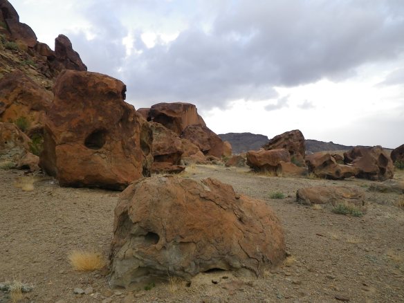
Big Bend Ranch State Park. One of my favorite places to run anywhere. Texas’s biggest state park, by a huge margin, only receives a small fraction of visitors compared to the neighboring national park. At over 300,000 acres, with a well-developed and maintained trail system easily accessible from the highway, Big Bend Ranch offers an austere paradise for those seeking solitude in the desert. I regularly run long loops in the park, and other than the two event weekends of the year, have yet to see another person on the trails. I’ve even run a trail two weeks after I originally ran it, only to recognize my own footprints in the dirt. The running is phenomenal, as are the surrounding mountains and desert vegetation. Some of the trails are old 4×4 roads, while most are single track with technical sections and undulating elevation, and there are untold options for connecting routes. The two best spots to access the main trail system are across from the Barton Warnock Center, which is one of the park’s headquarters just outside of Lajitas, and the Contrabando trailhead. Perhaps my favorite run starts at Contrabando, heads out towards the Dome trails, and returns via the Fresno Divide. And if the thought of running solo in the wilderness is in any way uncomfortable, I’ll mention that each January there is an ‘Ultra’ with distances of 10k, 30k, and 50k. Kind of fun to run with a small crowd out there one day a year. It’s also worth noting that the trails are open to mountain biking, with a bike festival happening each February.

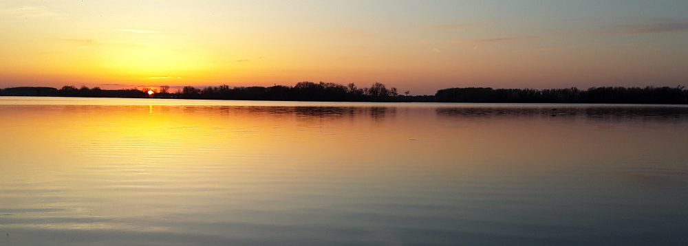
Lajitas Airport Trails. East of the resort town of Lajitas sits the Lajitas International Airport. I’ve never seen a plane land or take off from there, but I’m told that they do. The important thing to know, however, is not that a flight to the Big Bend might be available if you know the right people, but that there is a network of trails open to public use accessible from the highway at the airport turnoff. These trails are only slightly more popular than the state park trails, as local mountain bikers ride them with some frequency, though the chances of having them all to yourself is still likely. At the trailhead is a map with routes, descriptions, and mileage. The trails are well signed and provide a diversity of terrain and scenery. As the trails are a bit closer to the town of Terlingua than the state park, one of my preferred sunset runs is the 5.5 mile Loop 3, with great views of the Chisos Mountains on your way out, and often brilliantly colored clouds across the western sky on the way back in.
Horse Trails? Town Trails? Study Butte Trails? These don’t have a name that I know of. In fact, I’ve never thought of calling them anything until now, though I run on them more than anywhere else since they’re a) awesome, and b) begin in the town of Study Butte (aka Terlingua, but not the Ghost Town) just behind the Motor Inn, which is now called something like Big Bend Resort and Adventures… Anyway, just behind the gas station/laundromat/campground there’s a dirt road that leads past a water treatment pond and through a pseudo golf course which is basically just a few greens and a couple of flags out in the desert. As you’re passing the shitpond, just find a trail and start running east, or south, or even north, anywhere but back to the highway. There are trails heading all over the place which are primarily used by the nearby stables to do trail rides. You’ll see a lot of ‘evidence’ of the horses, but their hooves do keep the trails nice and soft. You may even see some folks out on a ride, but there’s usually an alternate trail to turn off onto before you meet them, and the wranglers are friendly enough if you end up in the mix. It’s fun just to figure some things out for yourself, but as you choose your own adventure the trails might take you past old mining ruins, up Rough Run Creek, along a sweet ridge, on to Ocotillo Mesa, and even all the way back to Indian Head, which is the northwest corner of the national park.
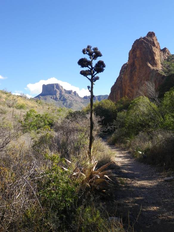
Big Bend National Park. To be honest, I haven’t done much running in the NP. Lots of hiking, lots of canoeing, but hardly any running and nothing noteworthy at that. There are plenty of options, however, just a lot more people and potentially long drives to get to the trailheads if you’re not staying in the park. Most of the trails are clearly marked and travel through some striking terrain. You also have the option to run up in the Chisos Mountains, where the temps are generally significantly cooler than in the desert down below. They are real mountains, however, so be prepared to run up/down a mountain, and the trails, as already alluded to, will be more crowded in the Chisos than anywhere else. If you want to do some desert running in the park, try cruising along one of the unpaved roads, such as the River Road or Old Ore Road. (Avoid Maverick, unless you don’t mind being plastered in a dirt patina from the clouds of dust you’ll be eating each time a car speeds by on the washboard.) Or, for a more authentic trail experience, head out the Marufo Vega until the junction with the Strawhouse Trail and follow the wash back down. Epic desert views abound.
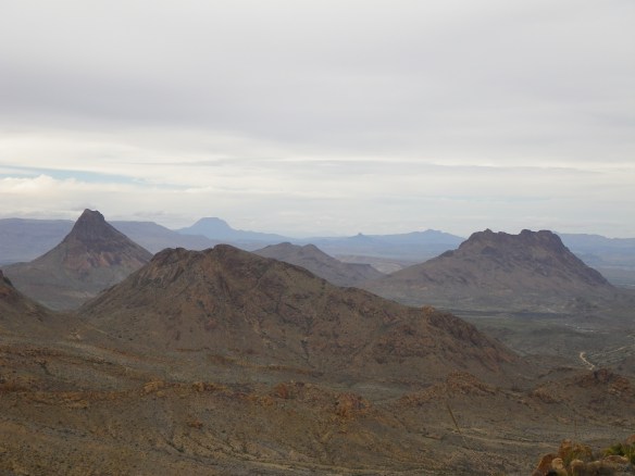
Terlingua Ranch. The Terlingua Ranch comprises thousands of acres of land adjacent to the national park and north of the Terlingua Ghost Town. While a true working ranch in the late 1800s, the land has now been parceled off into small swaths of barren desert. As you approach Terlingua from the north, you will begin to notice all manner of dwellings scattered across the landscape for as far as the eye can see, an unbridled sprawl of anything from conscientiously built eco-homes to abandoned buses and decrepit trailers. Personal junkyards abound. All of this is connected by an immense network of private dirt roads maintained by the Ranch. I mention this here because with the ever-growing popularity of Airbnb in the area, many visitors find themselves ensconced on the Ranch somewhere along all those miles and miles of dirt roads in lodgings which are many more miles from anywhere near the parks. All of the above mentioned locations are much more enjoyable to explore, in my opinion, than the Ranch, but, having said that, I run out there quite a bit and the empty roads provide plenty of possibility. I will say that running out there can be a bit intimidating. It’s like jogging suspiciously across the set of a bad Billy Bob Thornton movie – you will find yourself looking cautiously between rusted cars and bullet riddled washing machines, knowing that a heavily armed someone might certainly be living in one of the decaying vans in the back, and imagining that they’re not the kind of people that live out there because they want to see some dude in short shorts trotting through the privacy of their conspiracy riddled reality. Keeps things exciting, I guess, the wandering imagination that is. I will end by saying that the Ranch can be a great place to see wildlife, such as deer and javelina, and you can take your dog along, which you can’t do in any of the parks. So, if it’s where you’re at, get after it – the gunshots will be a strong motivator for negative splits on an out-and-back.
Davis Mountains. As mentioned in the beginning, the Davis Mountains lie at the far north of the Big Bend, and are often included in vacations to the region. This area is home to the McDonald Observatory, Ft. Davis, Davis Moutains State Park, the Chihuahuan Desert Research Institute, and by far some of the most scenic driving in the state of Texas. And, if you happen to be there, they’re also home to some great running trails through those very mountains and the northern part of the Chihuahuan Desert. The Research Institute has several miles of desert trails (along with botanical garden and a cactus greenhouse), while the state park offers multiple options traversing some steep rocky terrain. To test your mettle try starting at the campground, heading straight up the Old CCC Trail, dropping down the Fort Davis Access Trail, running around the fort, returning up the canyon and then up some more and all the way back down the Skyline Drive Trail. The other side of the highway also offers a challenge in an 11-mile ‘lollipop’ including the Sheep Pen Canyon Loop. Keep an eye out for the aoudad.
I guess that’s it. A brief guide to running in the Big Bend. Watch out for snakes, the sun, and all the spiky things. With hundreds of miles to choose from, I probably won’t see you out there, but have fun exploring.
