
Been a busy couple of weeks, both at work and not at work. Set the intention to spend as much time as possible out of the house, and have done my best at the follow through.
As winter turned to summer, I knew there were a lot of things left over from last year that I wanted to make sure to experience before the end of this one. Goals, one might call them. Places to see and things to do. Trails to walk and rivers to run. The idea then, that these numbered summer days were already slipping past without the number of goals decreasing stimulated even greater motivation than usual. I’ve been very fortunate to have recently enjoyed opportunities to live out several of those specific objectives.
This is not to say I have not appreciated the many opportunities that sporadically, and also intentionally, came about beforehand. The much anticipated time with my mom, all the spontaneous river trips and hikes and travels in May and June. I certainly feel fortunate for all those experiences. However, last year, my first summer up in the Interior, I tried hard to maximize my time. To do as much exploring as possible, to get to know the area and all it had to offer. And I definitely had a great time figuring out a lot about the region, learning more with each weekly outing, with each new trail hiked, and each section of river explored. But there is so much to do here, it felt like I barely scratched the surface, and there were a handful of trips specifically that I simply couldn’t get to due to weather, time, lack of partners, etc. These became the thoughts that held over, the trips dreamed of in the dark days of winter, the ones now demanding to be carried to fruition. Here’s three of them.
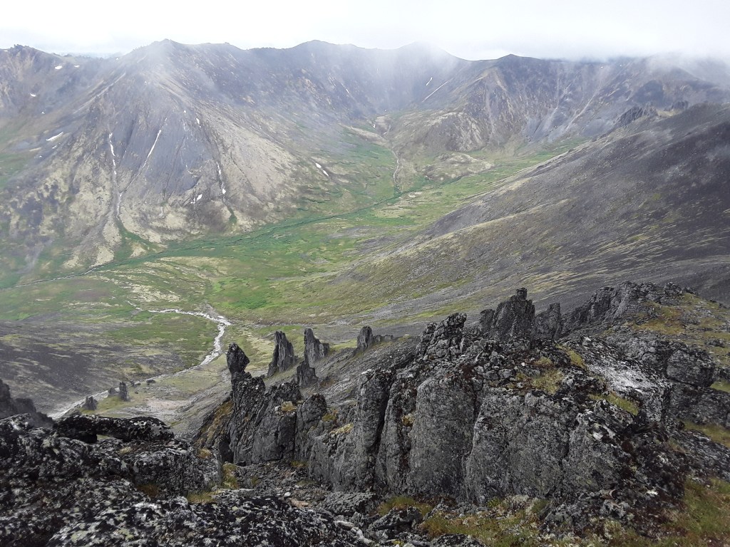
Chena Dome
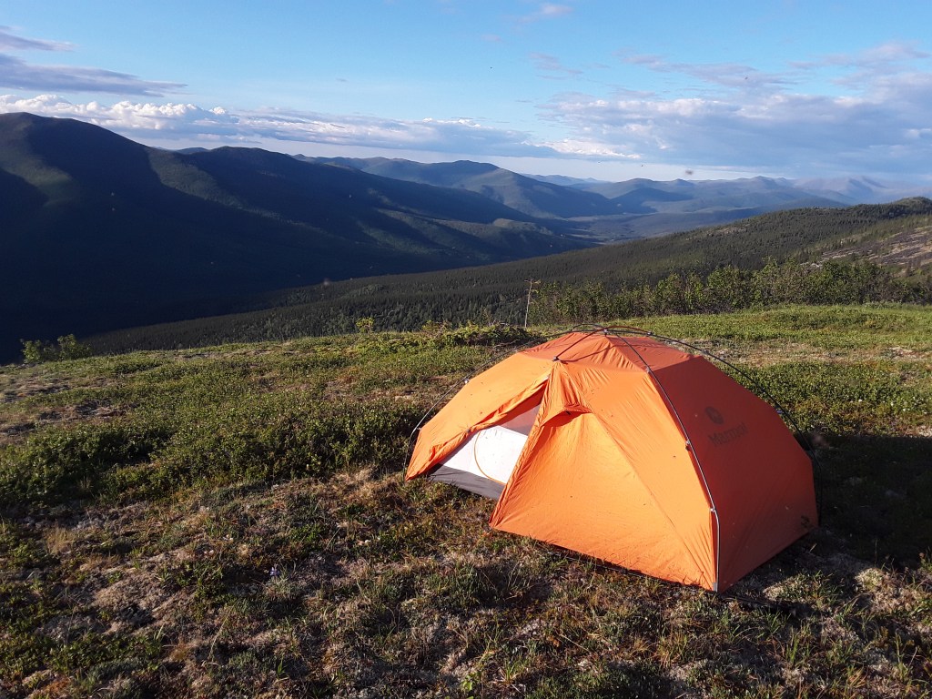
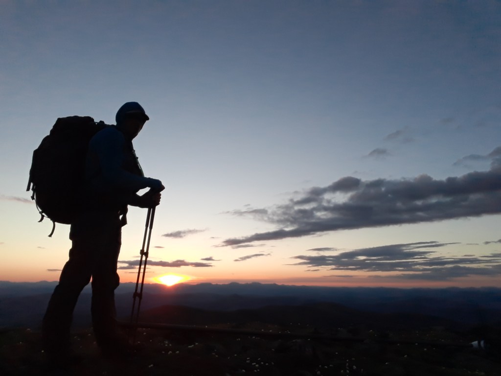
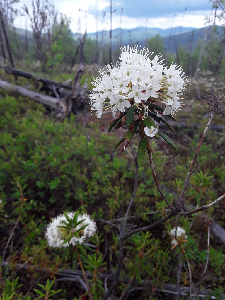
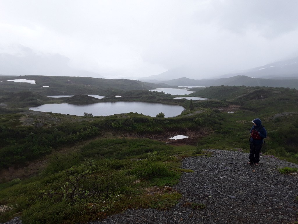
The Chena Dome trail is a 30 mile backpacking loop with a total elevation change of 14,100’. The math there basically equals: Ooof! I had the last minute idea to hike the trail on the Solstice, mostly to experience the longest day of the year out in the mountains. I wanted to be walking during the late evening light, which is phenomenal this time of year. The hours between 10pm and the early morning are incredible due to the angle of the sun as it hovers on the horizon—but obviously elusive for people that need to sleep at night. As I began to walk, I decided I would try to get all the way up to the top of the dome around midnight. At just below the Arctic Circle, the true ‘Midnight Sun’ cannot be seen from Fairbanks as it will dip slightly under the horizon, but I had read that from a high enough vantage one could indeed watch the sun not set for a day. Seemed like it was worth a try.
Like many of the bigger treks around here, the trail is also notorious for being void of water. There is always a balance to hiking many of the better known local routes as one must determine when the snow might be thin enough to complete a route, but also when there might be enough of it in meltwater pools to provide drinking water. And then there’s dealing with when the mosquitoes might be better or intolerable. Anyways, I did an online trip report for members of the local hiking club with details for anyone thinking of heading up that way. A slightly edited version follows:
“Few people been asking as to Chena Dome conditions. Quick report with the most pertinent info first, followed by fluff and photos.
Water: There is some water out there, but not a whole lot. Small puddles in the saddle between mile 7 and 8; a few nice pools before and after milepost 12; full cisterns at the shelter (half-barrel out front, and covered clean water on the other side); and, thankfully, several filling spots in a marshy area at the end of mile 24. I discovered first thing that my filter wasn’t really working all that great when I started pumping in the mudponds at mile 7. We’ll see how that works out…
The question of how much water to carry should not be taken lightly! (See what I did there…) My max capacity was one US gallon and I often wished I would have thrown in another Nalgene for peace of mind. It was close to 80° yesterday, and hiking those hills was no joke. I will admit to feeling very sorry for myself indeed when around mile 22 I resigned myself to hiking all the way out (which would have made for 19 miles) due to fading prospects of finding water.
Bugs: Oh buddy, you betcha. Not a trip for the insect averse person. First day was mosquitoes; second day was mainly clouds of those little black flies that like to dart deep into nostrils, eyes, and all the way to the back of your esophagus when you’re panting for air on the uphills; third day was a mix of both. There were a couple of times I did indeed feel like an arctic caribou in July. I even checked my stomach for warble flies when I got home. God help you when the wind stops blowing.
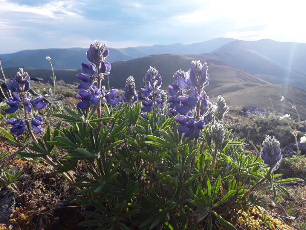
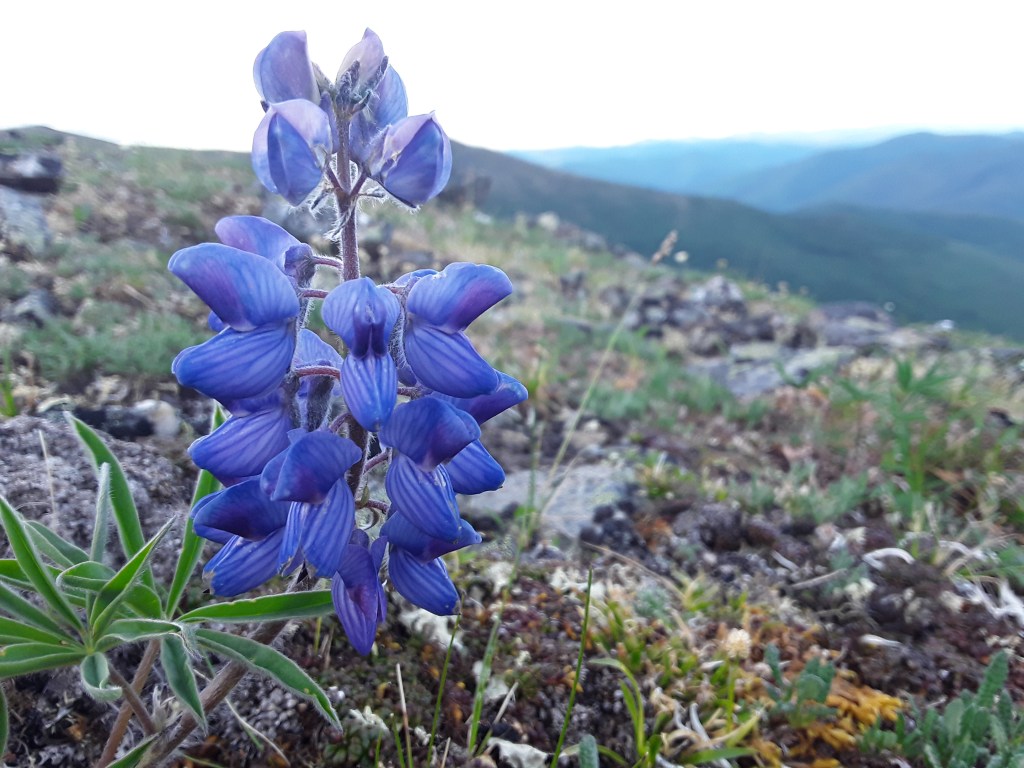
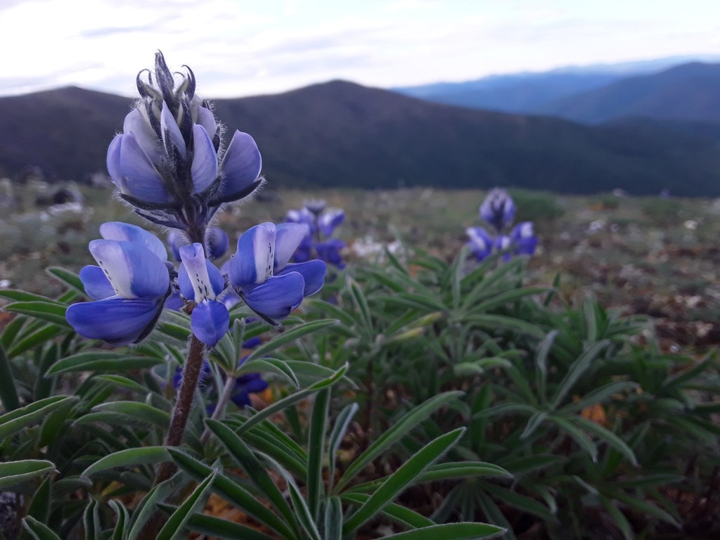
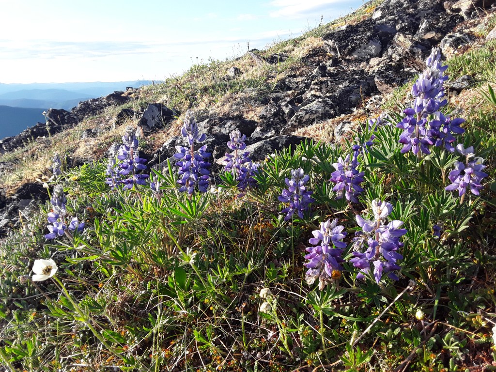
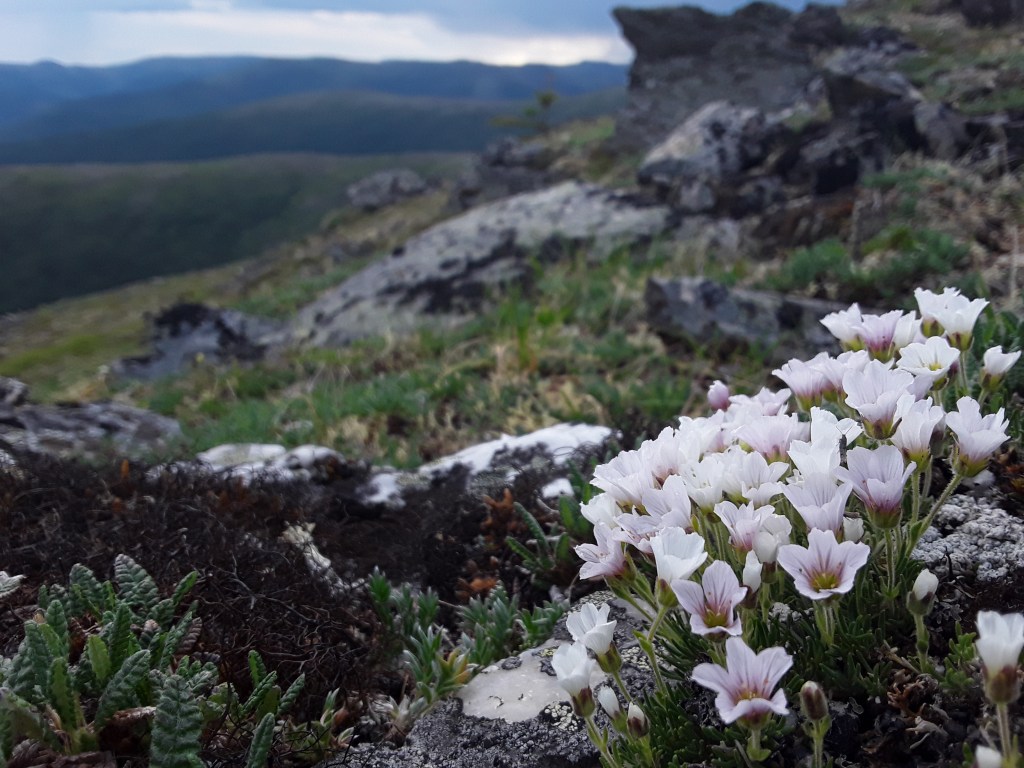
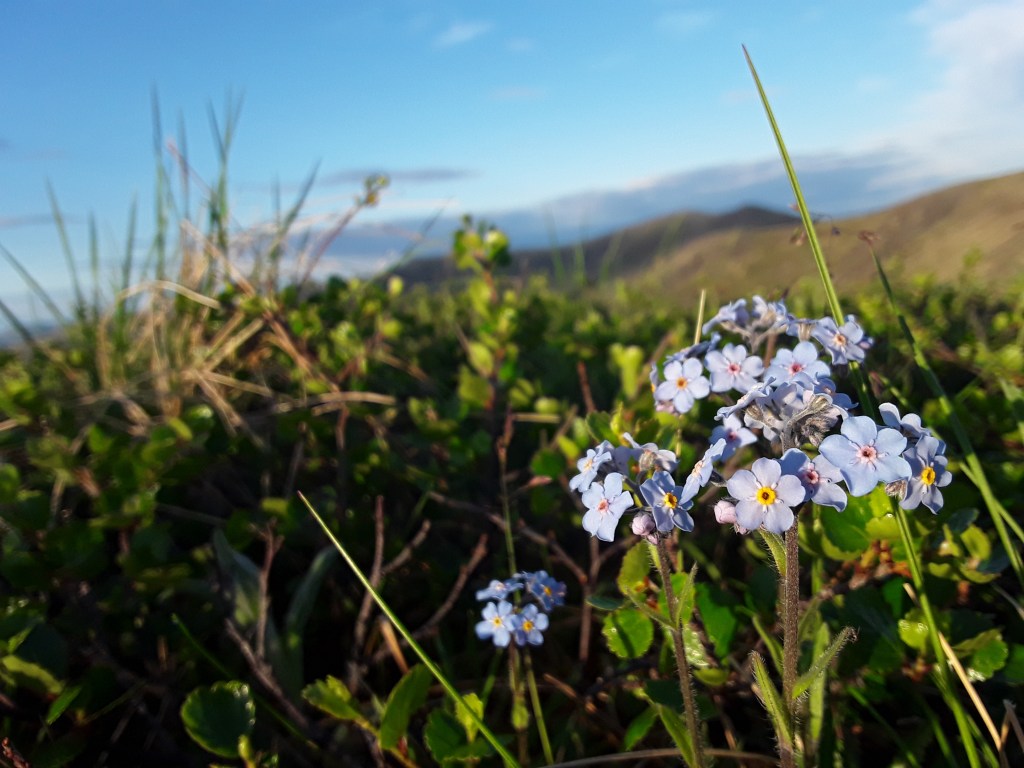
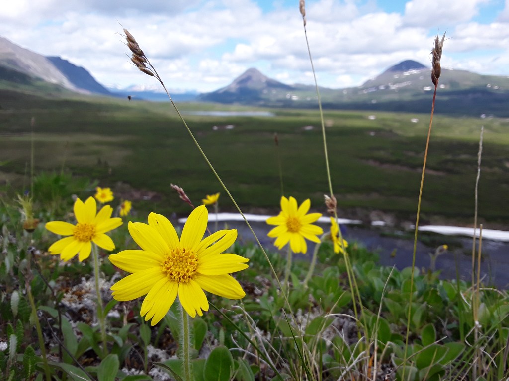
Wildflowers: Everywhere!
Highlights: Started the trip on the evening of the 21st hoping to get up high and watch the sun not go down. Last December I did a dawn-to-dusk winter solstice walk of Upper Angel Creekside to the winter trail, and didn’t see the sun at all that day, so it was cool to observe the drastic difference in approximately the same location. Parked at the lower lot and used the road mile to the upper lot as a warm-up rather than highway hobbling at the finish. Got going around 6 p.m. just in time for the remnants of last weekend’s storms to roll through. A few sprinkles early on, but nothing but clear skies and a light breeze once the climbing began in earnest.
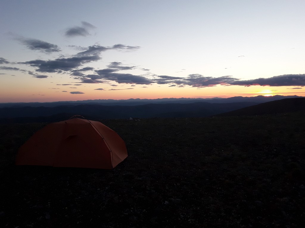
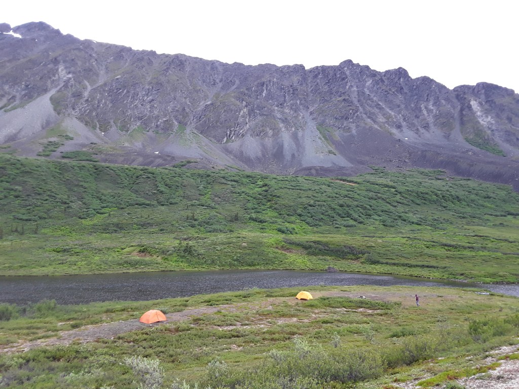
Hadn’t necessarily planned to go to the top of the dome that evening, but after a while it seemed like the obvious destination. Around 11 the sky started to change colors to pinks and purples all around. It was amazing to continually walk from the shadow of one hill back into full sun at the top. A heavy pack and steep terrain called for slow steady plodding, but I finally made it to the summit about a half-hour after midnight. The sun was just touching the mountains, but still fully visible above the jagged horizon in the distance. Hung out until 1 a.m. Ate some food, took a few photos, looked around for a good long while.
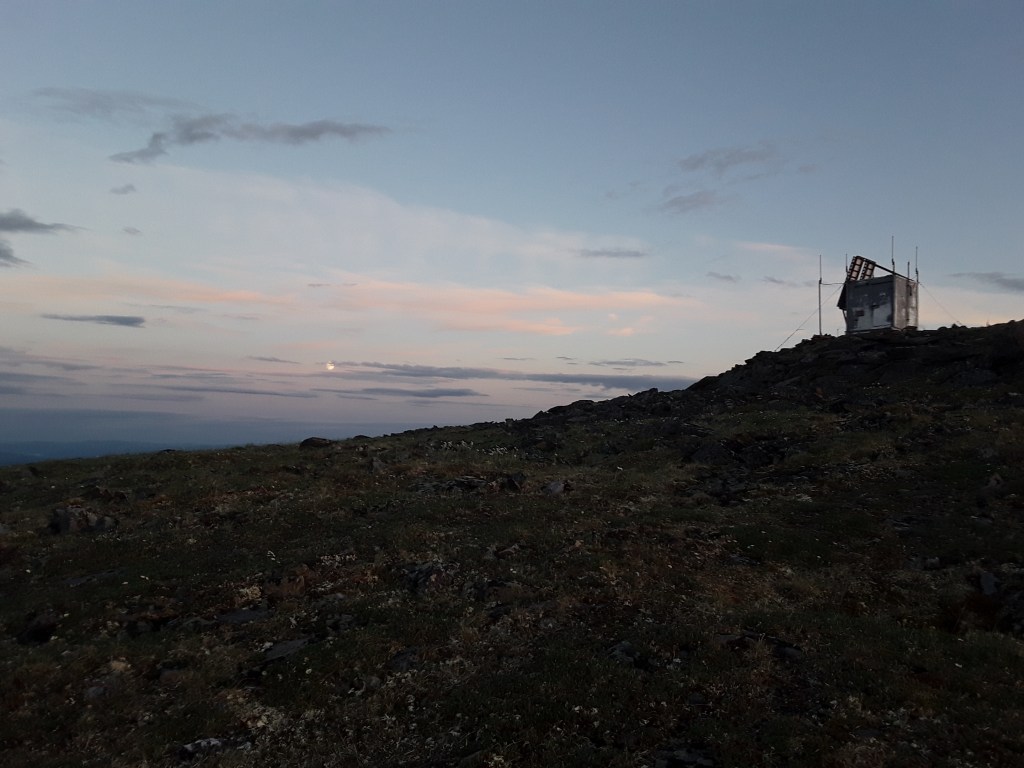
I thought about setting up my tent on top of the dome, but some clouds on the horizon encouraged me to drop down a couple hundred feet to a flat mesa instead. On the way down, I had a slightly different vantage point of the skyline, and at the bottom of the hills the clouds in the distance suddenly changed to an intense crimson, which quickly faded away. I found a spot to sleep, set up my tent, and looked over again to see the same clouds turning a bright salmon color, and the sky behind them lighting up white and blue. Sunset to sunrise in the span of 15 minutes. That’s my story at least, and something I won’t forget for a long time.
As for the rest of the hike, all good. Walked up and down a bunch of big hills in the heat yesterday, thankfully found water at 24, spent another night on the trail, and cruised out this morning. Happy days.”


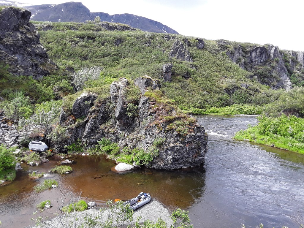
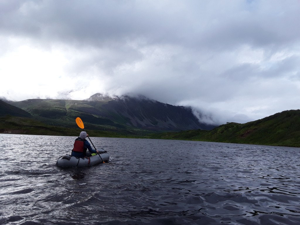
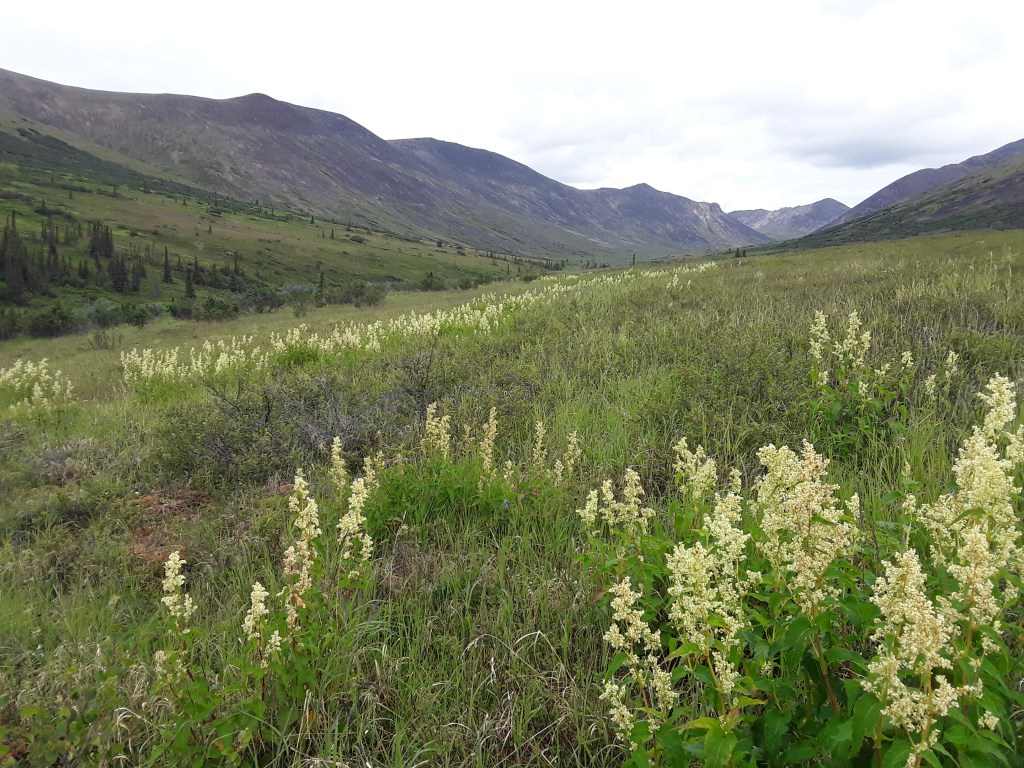
Delta River
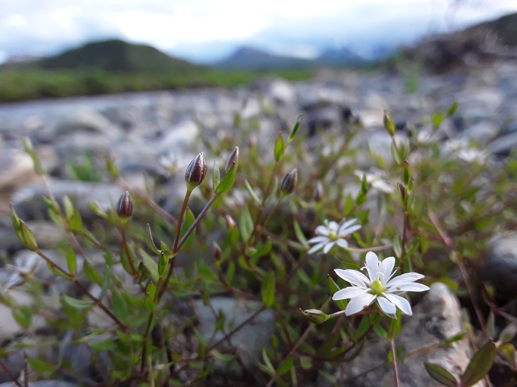
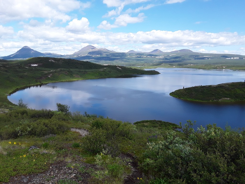
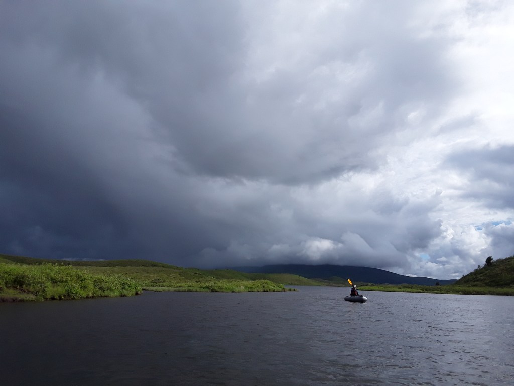
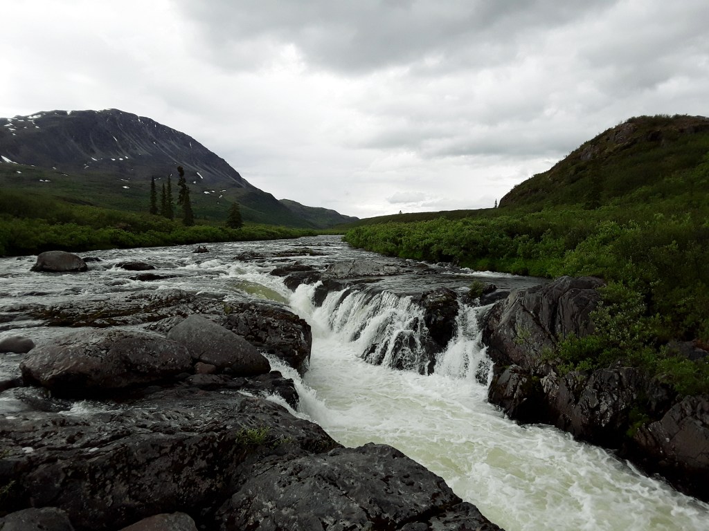
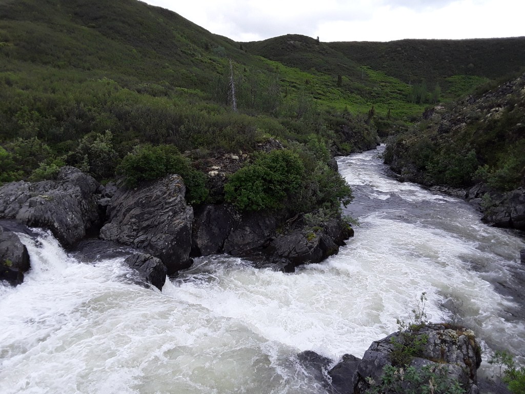
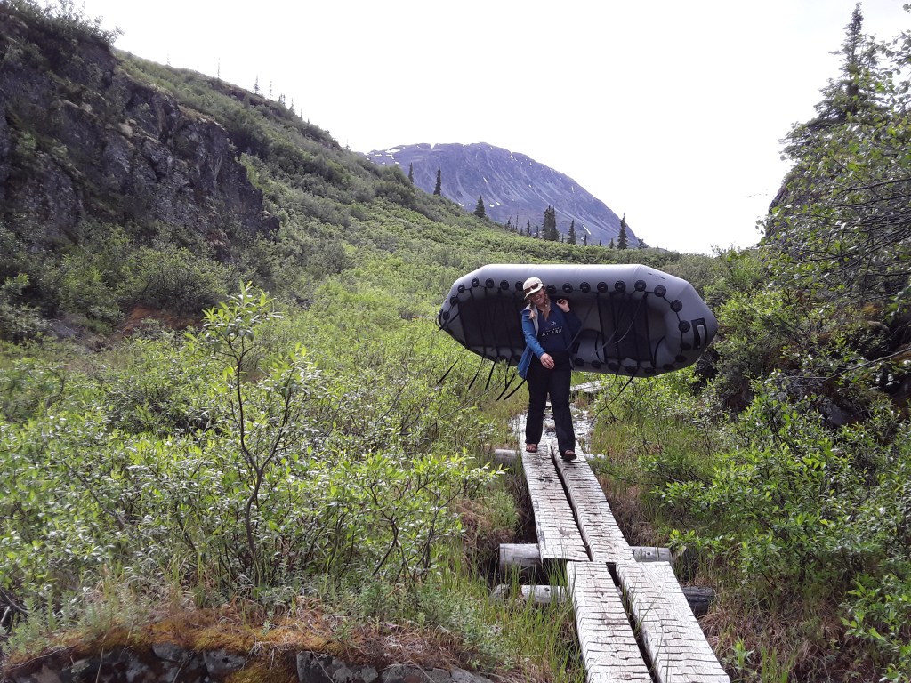
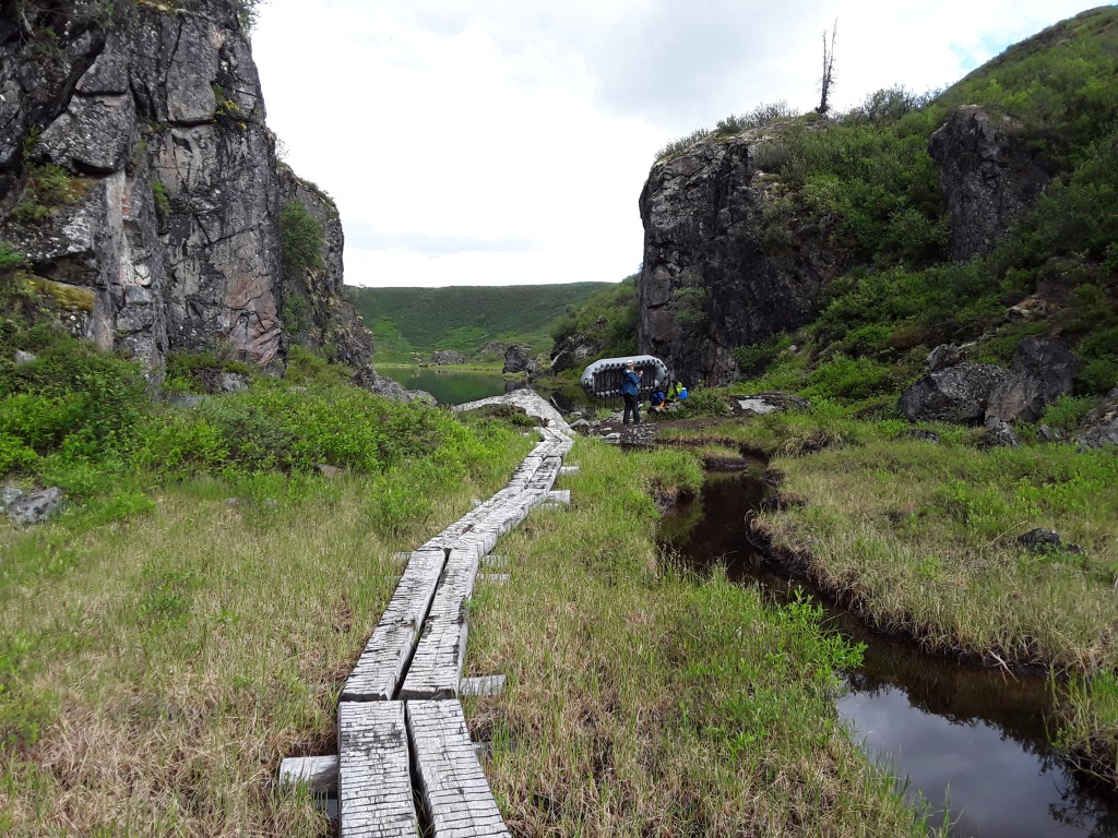
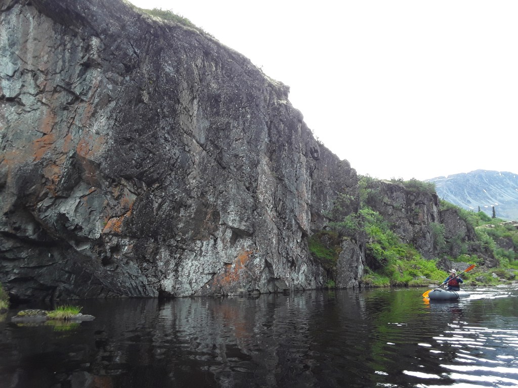
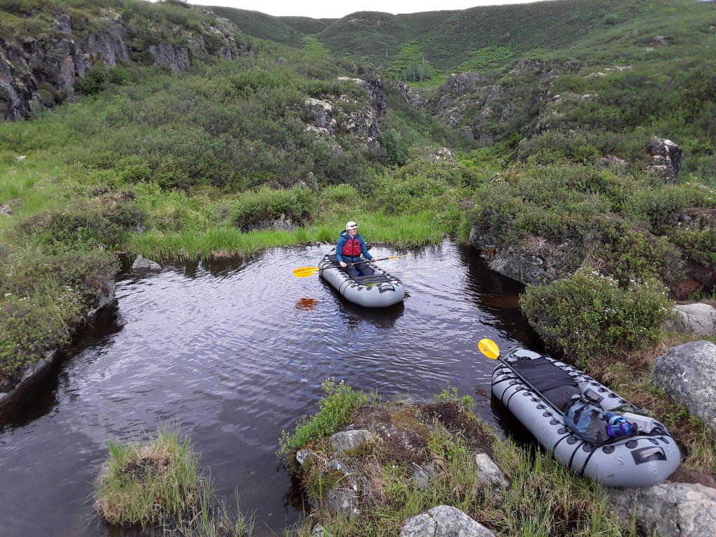
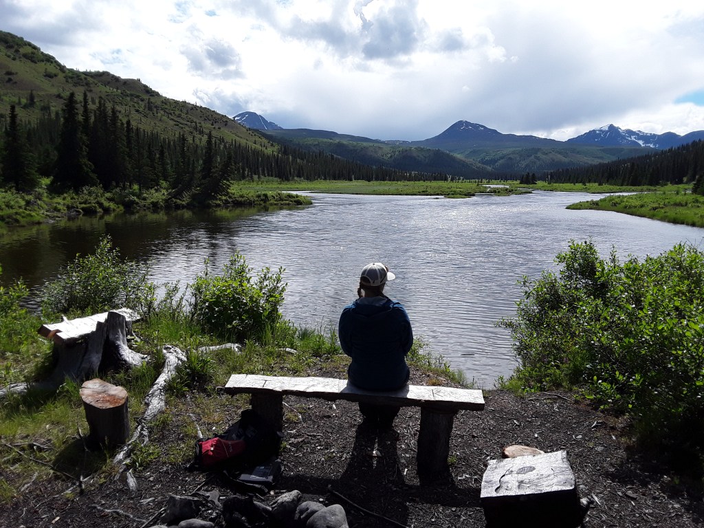
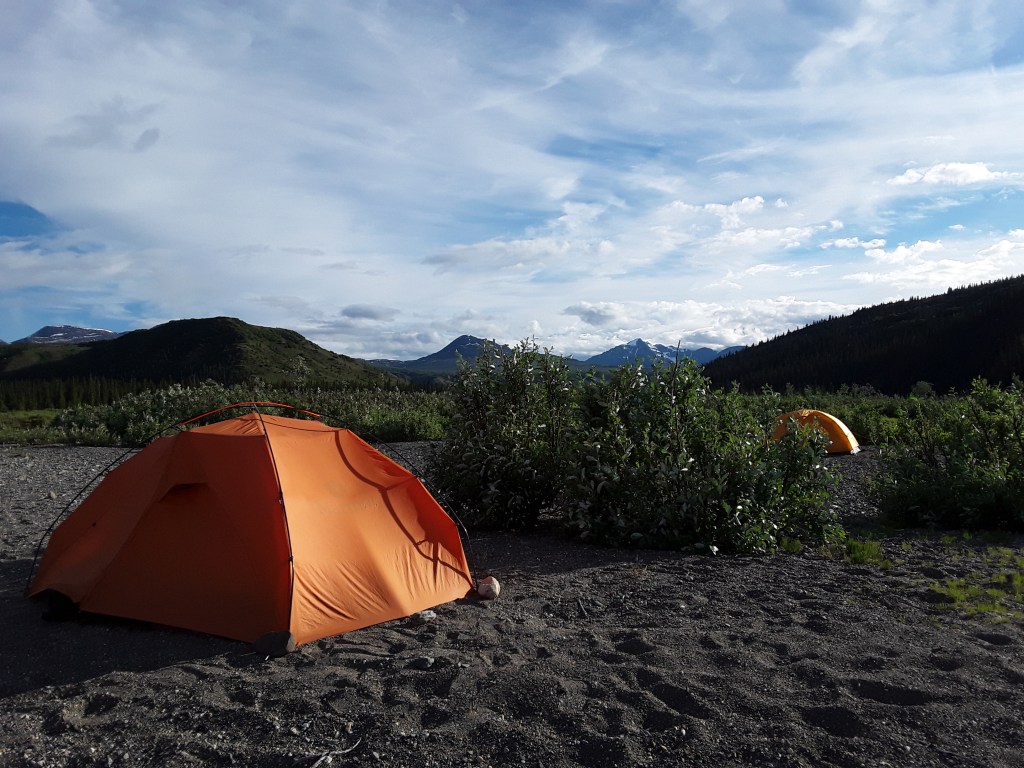
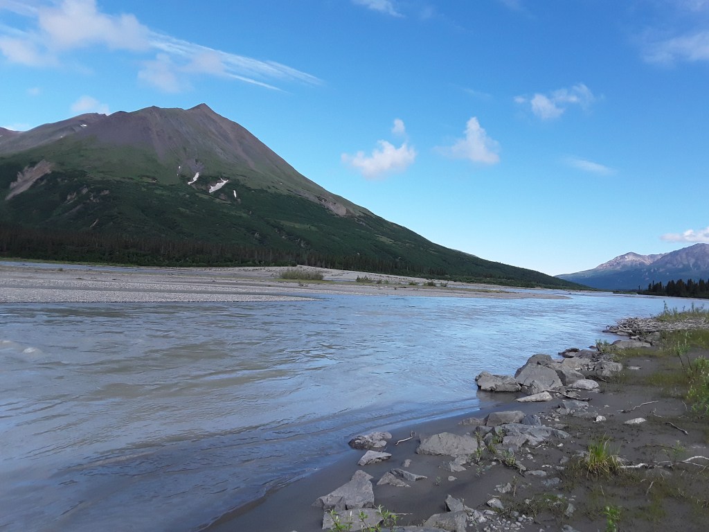
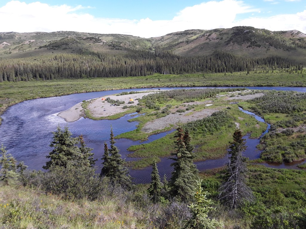
The Delta River is not to be confused with the Delta Clearwater River, which I’ve mentioned here a few times, though they may both be found in the proximity of Delta Junction. The Delta originates in the Tangle Lakes of the Alaska Range and flows north into the Tanana. It starts with a nine-mile paddle through several large lakes which connect with each other and eventually pour out into a river. From the beginning of the river, one floats a couple of miles before coming up to an interesting portage which involves carrying boats and all other gear up a hill and across some wetlands on a bunch of planks. There you put your things together again, paddle across a tarn, get out, and then portage some more. After that there’s a little section of small rapids followed by easy floating for about twenty more miles through some pretty spectacular scenery. We spent three days out and got a good mix of Alaska weather—that is to say a couple days of steady headwind, a good bit of rain, a fair amount of sunshine, and a chilly gray morning to finish. I’d been wanting to do this one for a while, but couldn’t ever find anyone to go with and help out with the shuttle. Thanks to my new ‘Bro’ MB for making it happen and smiling through all the conditions.

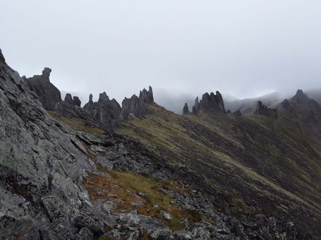
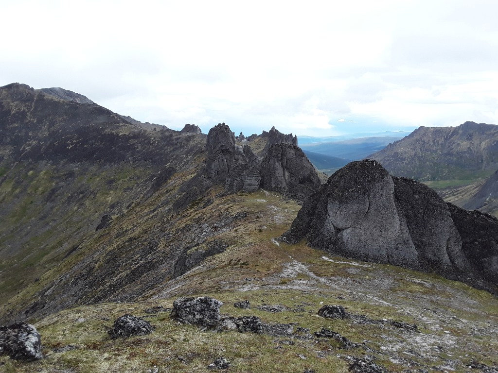
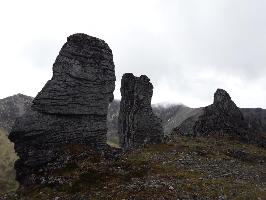
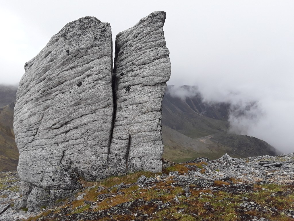
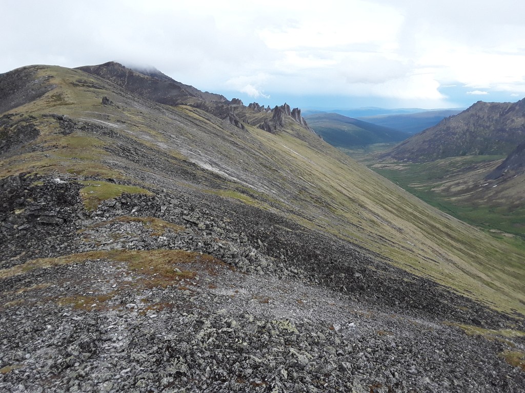
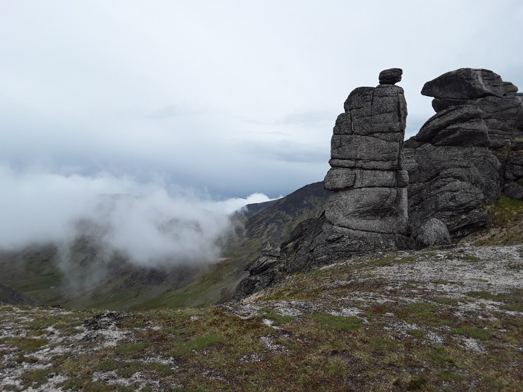
Mt. Prindle
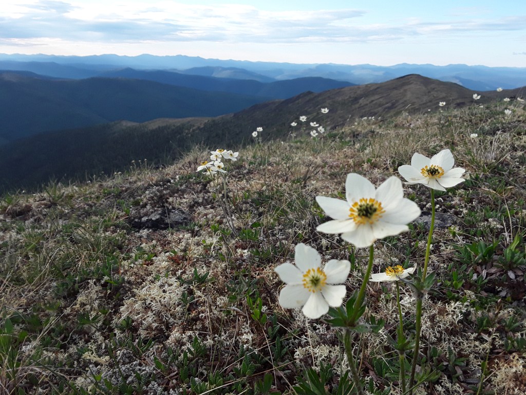
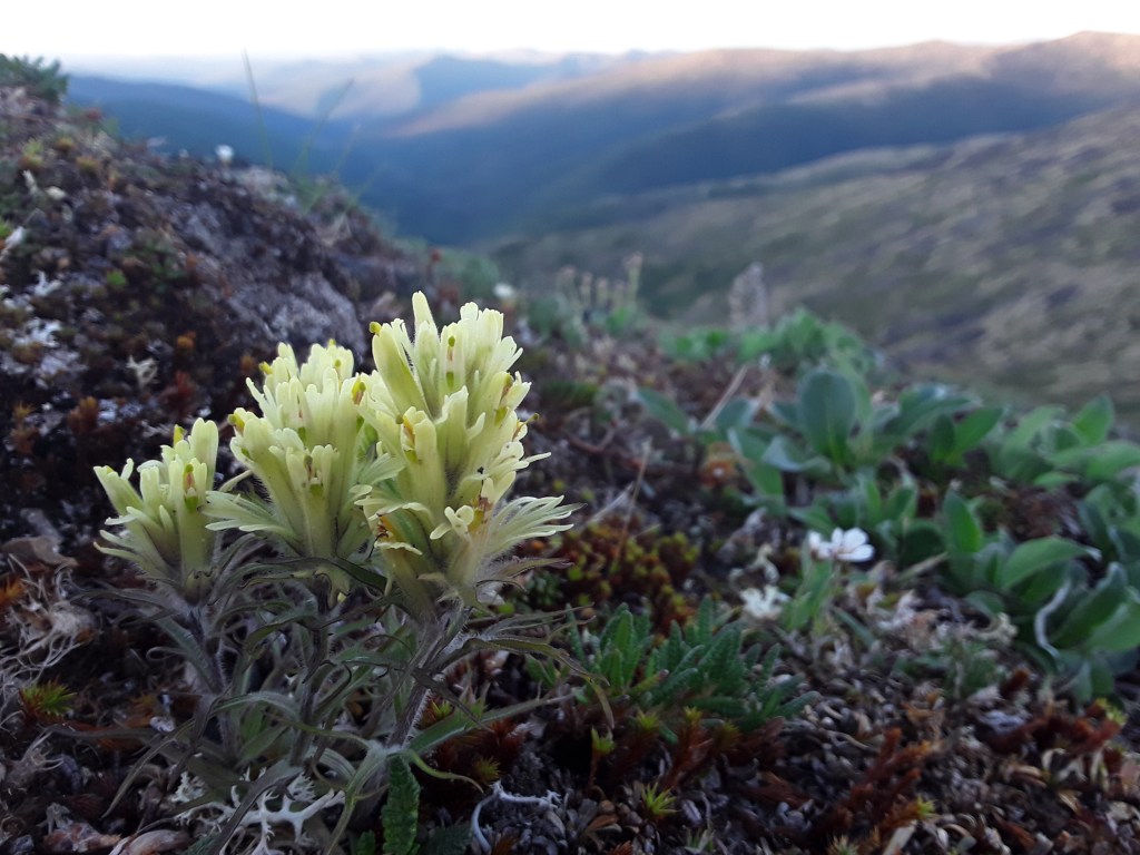
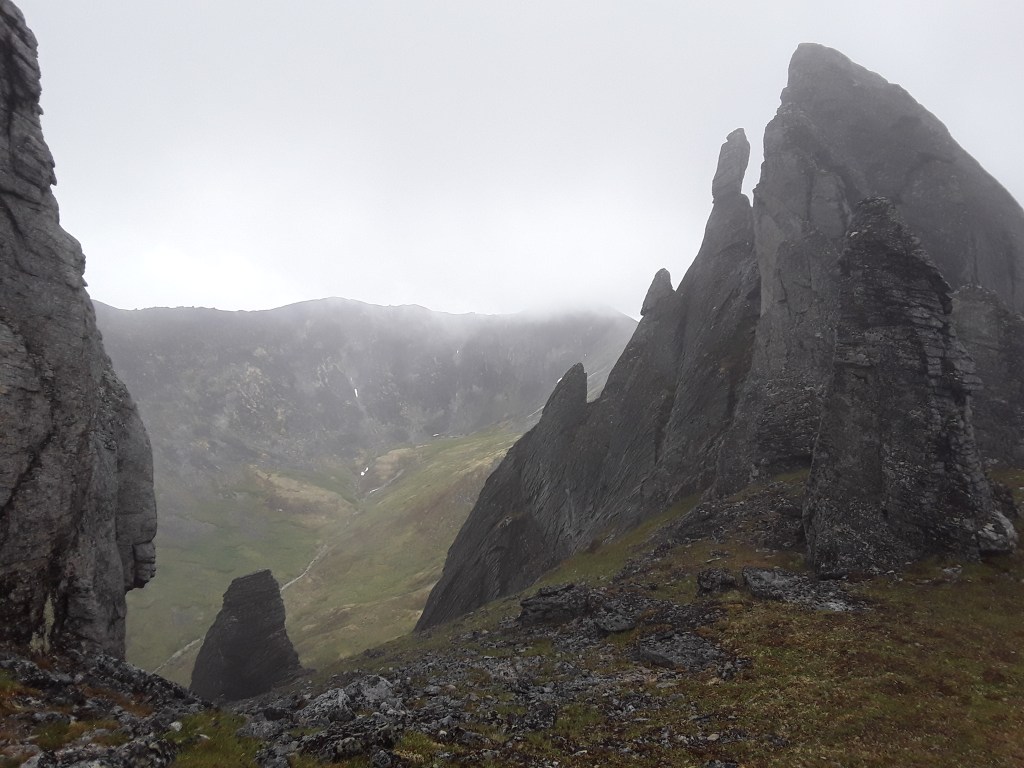
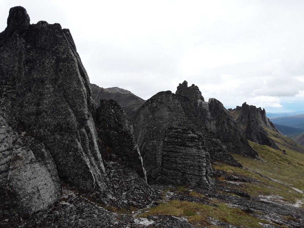
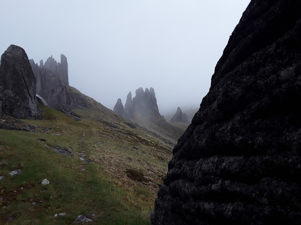
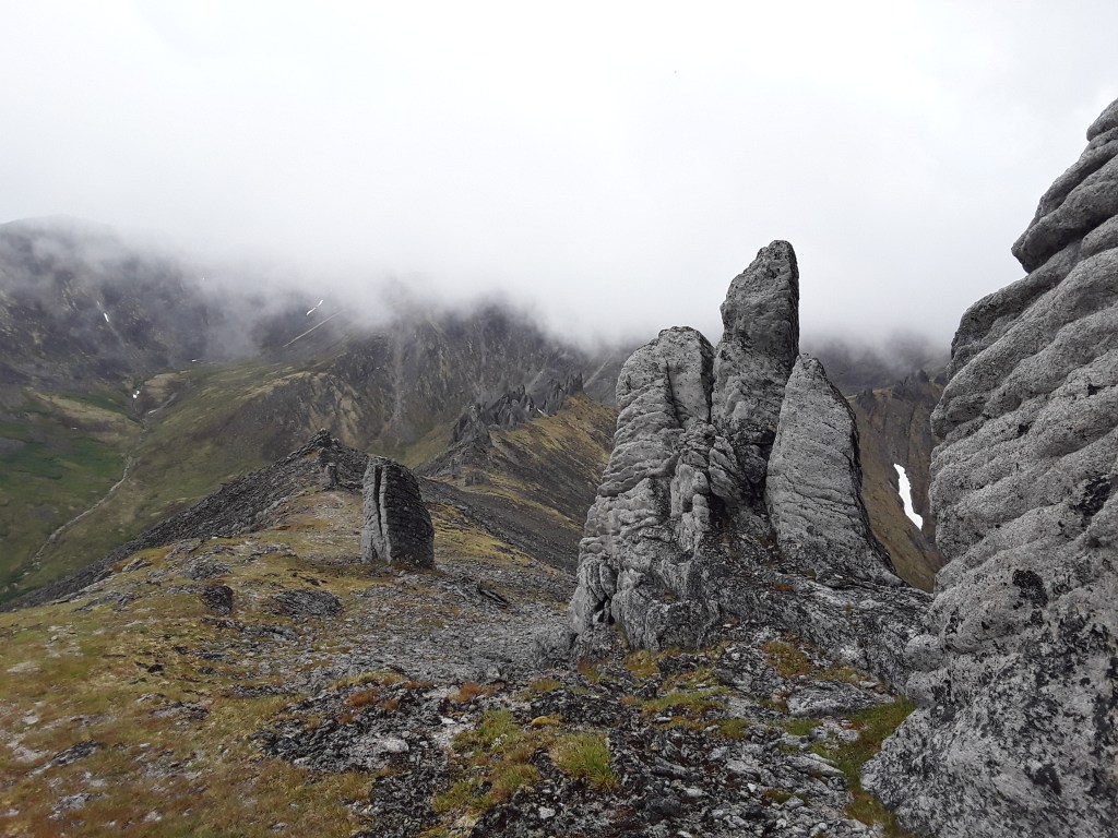
Mt. Prindle is the highest peak in the White Mountains, which the mountain range just north of Fairbanks. Chena Dome, and a whole bunch of other domes, may be found in the White Mountains, as well as a good percentage of locations I’ve written about this past couple years. Prindle boasts an elevation of just under 5,300’, which means the Whites aren’t nearly as dramatic as other ranges in Alaska, but they have their own special beauty. They kinda grow on a person. Most of the scenery is represented by low lying hills covered in birch and stunted spruce trees. Every so often, however, one can get up above the trees for some amazing views, and encounters with seemingly erratic rock formations generally known as Tors. I tried to get up Prindle a couple times last year, but was shut down by storm after storm. Finally got lucky yesterday, though I did get hammered a couple times by passing showers. Was happy for the low cloud scenery and the cool weather. The complete white out before I descended back into the valley just made things a little more exciting. Some of the most amazing ridge walking I’ve ever done, and a truly special place.

Thanks for the beautiful pictures of places that I cannot be. Age has caught up with us. I never cease to be in awe of the beautiful places God and incorporated into this planet whether it is in the mountains or the little stream that runs thorough my back yard.
LikeLiked by 1 person
Hey Dwight,
Thanks for checking out the site and for the positive comments. I am also always in awe of the seemingly endless diversity of the universe. And I love your reference to the backyard creek. There is beauty in all places. I am very fortunate that almost all of the locations on here are less than a couple hours from my house, and am thankful every day for the opportunity to live here. Take care.
LikeLiked by 1 person